Skip to content
Services et traitements des images aériennes
Twitter Facebook Linkedin
  • Français
  • English
DRONES IMAGING
  • Drones imaging
    • Who are we
  • images processing service
    • topographic service
    • thermographic service
    • agricultural service
    • automatic counting service
    • Use case
    • Product sheets
    • useful documentation
    • download guide
  • Trainings
    • training in photogrammetry metashape option
    • training in photogrammetry Pix4D option
    • Multispectral training
    • online photogrammetry training
  • Softwares
    • Agisoft Metashape photogrammetry software
    • RealityCapture photogrammetry software
    • Undet software
  • RTK Receivers
    • EMLID GNSS RTK Reach RS2+
    • Emlid GNSS RTK Reach RX
    • EMLID GNSS RTK Reach RS+
  • Sensors
    • Agrowing Multispectral cameras
  • News
  • Contact us
Menu Close
  • Drones imaging
    • Who are we
  • images processing service
    • topographic service
    • thermographic service
    • agricultural service
    • automatic counting service
    • Use case
    • Product sheets
    • useful documentation
    • download guide
  • Trainings
    • training in photogrammetry metashape option
    • training in photogrammetry Pix4D option
    • Multispectral training
    • online photogrammetry training
  • Softwares
    • Agisoft Metashape photogrammetry software
    • RealityCapture photogrammetry software
    • Undet software
  • RTK Receivers
    • EMLID GNSS RTK Reach RS2+
    • Emlid GNSS RTK Reach RX
    • EMLID GNSS RTK Reach RS+
  • Sensors
    • Agrowing Multispectral cameras
  • News
  • Contact us

Blog

    News   Inspection of a photovoltaic power plant carried out by drone and aerial thermography

Inspection of a photovoltaic power plant carried out by drone and aerial thermography

  • July 13, 2021
  • 12:49 pm

Thermographic inspection of a photovoltaic power plant

Results obtained from 4352 aerial images taken by Tech Drone Service company.

Autocad plan built from thermal orthophoto on a 22ha area.

Defects map with thermal orthophoto layered

Orthophoto thermique

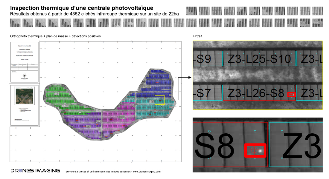
Above, the Autocad format map showing the 12,130 panels inspected. In red, detected defects classified by category “overheated cell”, “overheated cells constellation” and “module defect”.

Turnkey inspection reporting delivered to the design and construction manager before commissioning the site.

TECHNICAL INFORMATIONS

  • Data processing and reporting : Drones Imaging company.
  • Aerial Images source : Tech Drone Service company.
  • Spatial accuracy : relative centimeter accuracy.
  • Thermal orthophoto : 3cm GSD.
  • Covered area : 22ha
  • Drone : DJI P4P.
  • Photogrammetry software : Metashape
PrevPrécédentThermal inspection of a photovoltaic power plant carried out by drone and aerial photogrammetry
SuivantTopographic survey carried out by gyrocopterNext
  • Mentions légales
  • FrançaisFrançais
  • EnglishEnglish