Skip to content
Services et traitements des images aériennes
Twitter Facebook Linkedin
  • Français
  • English
DRONES IMAGING
  • Drones imaging
    • Who are we
  • images processing service
    • topographic service
    • thermographic service
    • agricultural service
    • automatic counting service
    • Use case
    • Product sheets
    • useful documentation
    • download guide
  • Trainings
    • training in photogrammetry metashape option
    • training in photogrammetry Pix4D option
    • Multispectral training
    • online photogrammetry training
  • Softwares
    • Agisoft Metashape photogrammetry software
    • RealityCapture photogrammetry software
    • Undet software
  • RTK Receivers
    • EMLID GNSS RTK Reach RS2+
    • Emlid GNSS RTK Reach RX
    • EMLID GNSS RTK Reach RS+
  • Sensors
    • Agrowing Multispectral cameras
  • News
  • Contact us
Menu Close
  • Drones imaging
    • Who are we
  • images processing service
    • topographic service
    • thermographic service
    • agricultural service
    • automatic counting service
    • Use case
    • Product sheets
    • useful documentation
    • download guide
  • Trainings
    • training in photogrammetry metashape option
    • training in photogrammetry Pix4D option
    • Multispectral training
    • online photogrammetry training
  • Softwares
    • Agisoft Metashape photogrammetry software
    • RealityCapture photogrammetry software
    • Undet software
  • RTK Receivers
    • EMLID GNSS RTK Reach RS2+
    • Emlid GNSS RTK Reach RX
    • EMLID GNSS RTK Reach RS+
  • Sensors
    • Agrowing Multispectral cameras
  • News
  • Contact us

Who are we

    Who are we

Founded in 2013, Drones Imaging is a design office stemming from civil and military engineering. It synthesizes technical expertise in remote sensing, geomatics, analysis, photogrammetric processing and aerial image capture. With over 25 years experience in remote sensing, Drones Imaging will offer you professional quality services in the fields of geomatics, photogrammetry, professional training and especially, continuous access to an advanced technology.

Drones Imaging

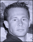
Loïc Hussenet

President

Analyst geomatician.

Photogrammetry, GIS and infrared specialist.
Photogrammetry and remote sensing trainer.

1998: Military joint imagery school.

Career made in a military drone intelligence unit.

Drones Imaging

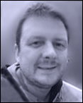
Constance Berthier

Production manager

Surveyor.

CAD, GIS and photogrammetry specialist.

Photogrammetry trainer.

2014: National School of Geographical Sciences. Geomatics, environment and photogrammetry branch.

Drones Imaging

Rémi Bouffort

Graphics

3D specialist, web designer.

3D modeling and simulation expert.

2013: Autograf school. 3D animator.

  • Mentions légales
  • FrançaisFrançais
  • EnglishEnglish