Skip to content
Services et traitements des images aériennes
Twitter Facebook Linkedin
  • Français
  • English
DRONES IMAGING
  • Drones imaging
    • Who are we
  • images processing service
    • topographic service
    • thermographic service
    • agricultural service
    • automatic counting service
    • Use case
    • Product sheets
    • useful documentation
    • download guide
  • Trainings
    • training in photogrammetry metashape option
    • training in photogrammetry Pix4D option
    • Multispectral training
    • online photogrammetry training
  • Softwares
    • Agisoft Metashape photogrammetry software
    • RealityCapture photogrammetry software
    • Undet software
  • RTK Receivers
    • EMLID GNSS RTK Reach RS2+
    • Emlid GNSS RTK Reach RX
    • EMLID GNSS RTK Reach RS+
  • Sensors
    • Agrowing Multispectral cameras
  • News
  • Contact us
Menu Close
  • Drones imaging
    • Who are we
  • images processing service
    • topographic service
    • thermographic service
    • agricultural service
    • automatic counting service
    • Use case
    • Product sheets
    • useful documentation
    • download guide
  • Trainings
    • training in photogrammetry metashape option
    • training in photogrammetry Pix4D option
    • Multispectral training
    • online photogrammetry training
  • Softwares
    • Agisoft Metashape photogrammetry software
    • RealityCapture photogrammetry software
    • Undet software
  • RTK Receivers
    • EMLID GNSS RTK Reach RS2+
    • Emlid GNSS RTK Reach RX
    • EMLID GNSS RTK Reach RS+
  • Sensors
    • Agrowing Multispectral cameras
  • News
  • Contact us

Emlid GNNS RTK Reach RS+

    Emlid GNNS RTK Reach RS+

EMLID REACH RS+

Emlid RS+ receiver - mono-band RTK GNSS comes with a mobile app

Compatible with any CORS (corrections services), Reach RS+ is the turnkey solution for surveying, topographic stakeouts and data collection with centimeter precision in open areas.

999€ technical support and training included


kit rs2
Reasch RS+

For any technical information, a quote or to order an EMLID RS+ receiver, contact us

Download datasheet

Key Features of the EMLID Reach RS+ Receiver

Operation with national correctional services.

emlid RS+ smartphone

Reach RS+ receiver receive correction datas directly via the GSM network from your smartphone, it fixes the coordinate in a few seconds even in difficult conditions. No additional device or software is required, all you need is a smartphone.

Corrections and log formats: NTRIP, RTCM3, RINEX

Smartphone operation via the free ReachView mobile app.

Emlid RS+ GCP

For point collection, just create custom projects by location. A name and an offset can be saved on each point. The results are then viewed from the project list and can be downloaded in near real time with your smartphone and then sent by email . Ideal for aerial works with Ground Control Points and automated import to photogrammetry softwares.

Export formats: DXF, CSV, GeoJSON, SHP.

Interoperable, works in base/rover configuration.

Emlid drone

Without a GSM network and therefore without corrections, use two Reach RS2 receivers. One in base station configuration to broadcast your corrections to the second receiver configured in rover mode (in local georeferencing or attached to a specific coordinate system). You can also record log files continuously for your post-processing operations.

EMLID Reach RS+ Receiver Specifications

Emlid specifications

EMLID Reach RS+ Receiver Specifications

Emlid Reachview

Point collection: save points, and export data to CSV

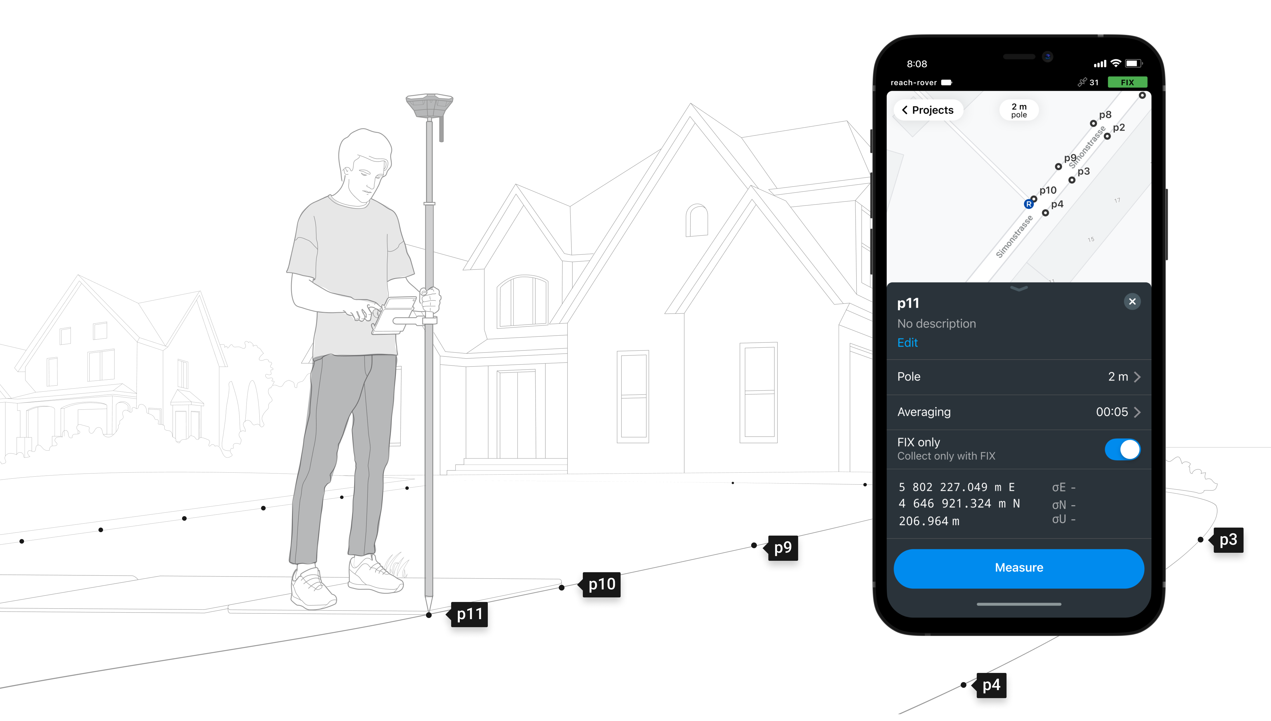
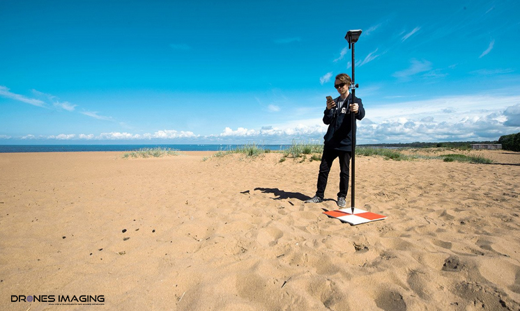
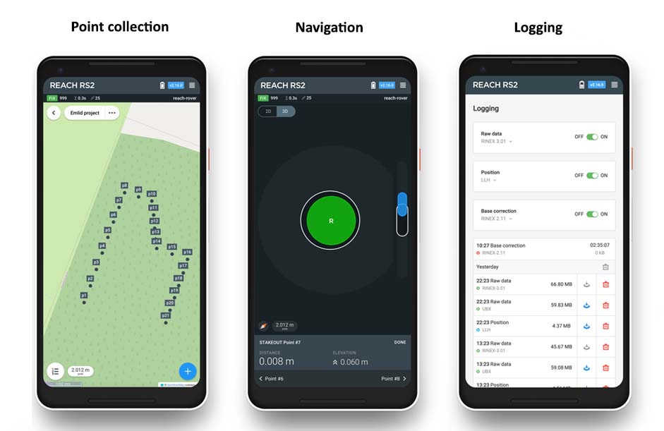
Record each position as a point with centimeter precise coordinates. Export projects and open them in GIS or CAD software like AutoCAD, ArcGIS, QGIS, and others.

Stakeout: find point’s position on the ground

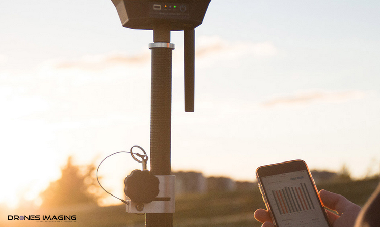
Stakeout is used to find exact physical locations of points. They can be collected in ReachView or imported from other CAD or GIS software.

Logging in RINEX: record raw data, position, and base correction logs

Record raw data, position and base correction logs. Point collection and recording of RAW data are independent processes and can be used simultaneously. ReachView has a simple and intuitive interface for logging configuration and control.

They trust us
Géo
cnrs
Inra
Cirad
Onera
Géomètre expert
Ifremer
  • Mentions légales
  • FrançaisFrançais
  • EnglishEnglish