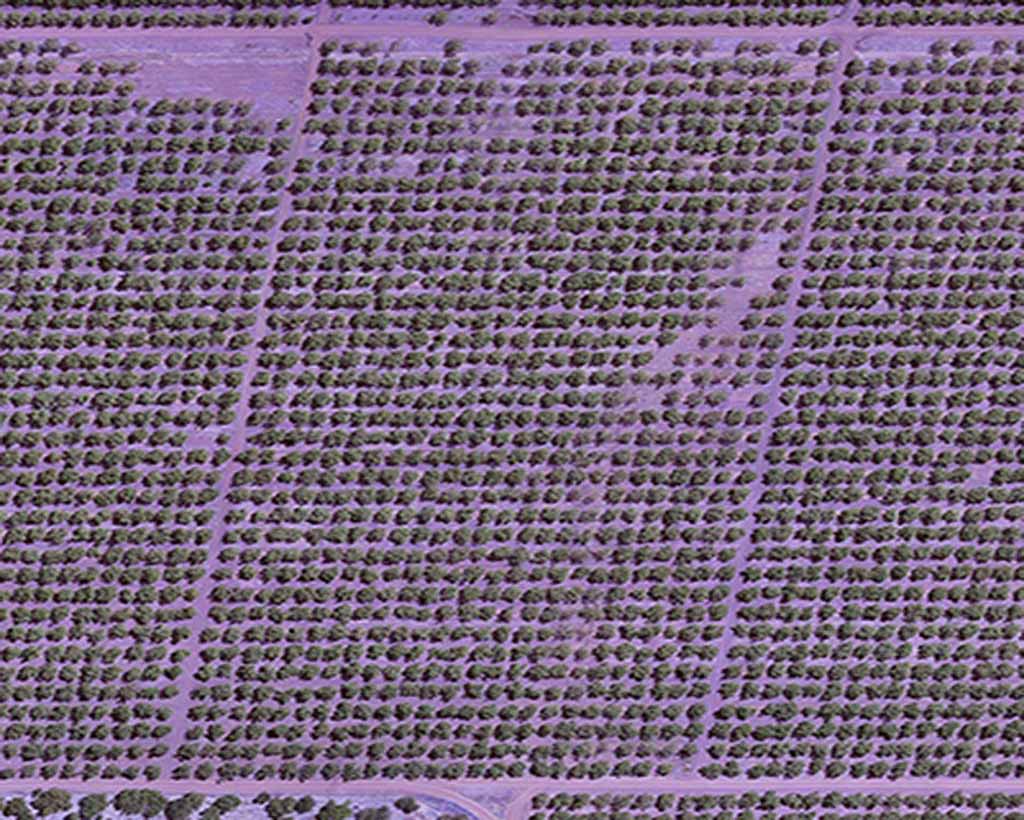
Especially designed using lenses compatible with many professional cameras, discover our range of sensors dedicated to vegetation monitoring.
Drones Imaging is the official dealer of Agrowing multispectral cameras. The best high-resolution sensor for aerial or terrestrial works in forestry, viticulture or precision agriculture.
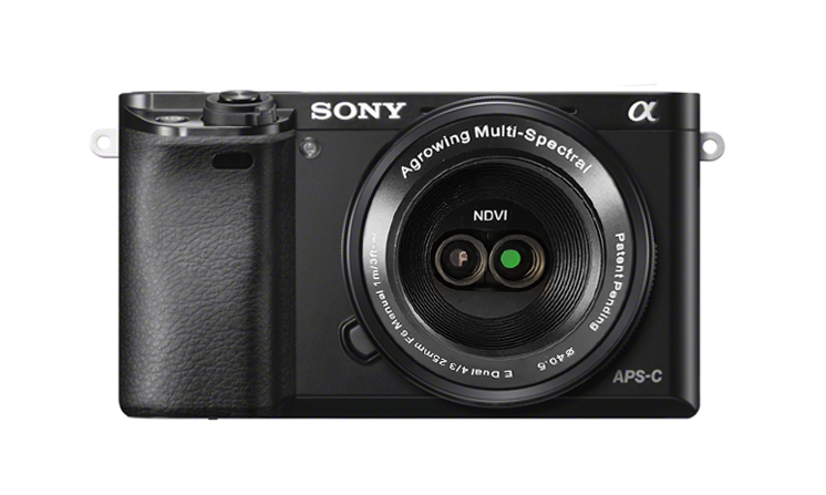
Thanks to its two interchangeable lenses (NDVI and Red-Edge), the A6000 Dual can instantly generate 4 bands of 10 Megapixels per shot: 450nm, 550nm, 650nm, 850nm with the NDVI lens or 450nm, 550nm, 710nm, 850nm with the Red-Edge lens.
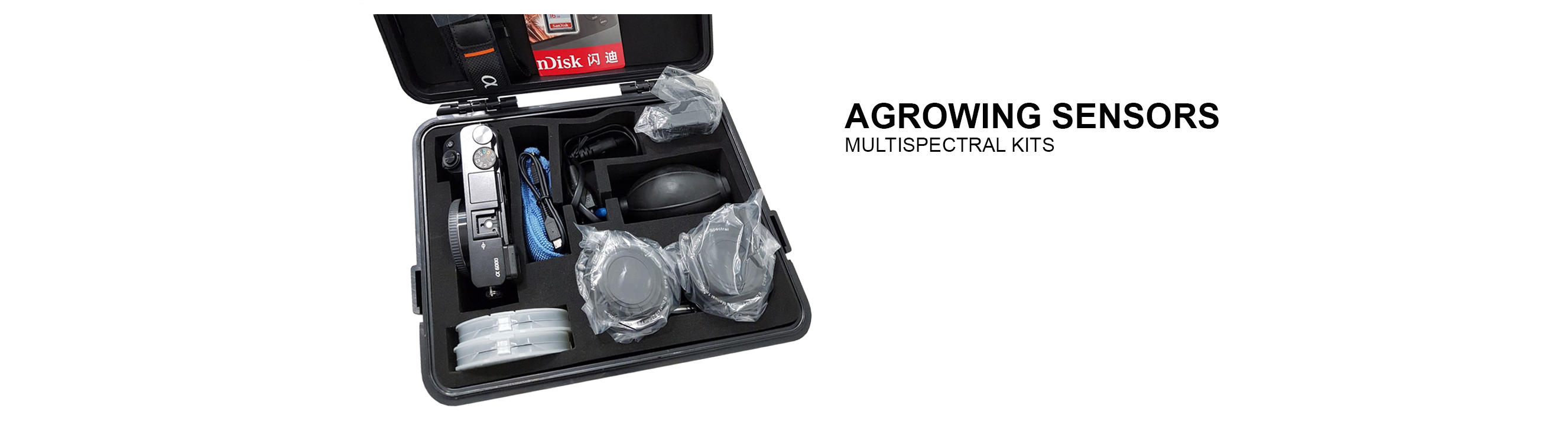
The kit includes a carrying case, the camera, the NDVI and RED EDGE multispectral lens, a maintenance kit, SD card and operating software.
GSD (100m AGL): 1.55cm
Spectral channels: 4 per intechangeable lens
Sensor resolution: 24Mp
Resolution per channel: 10Mp
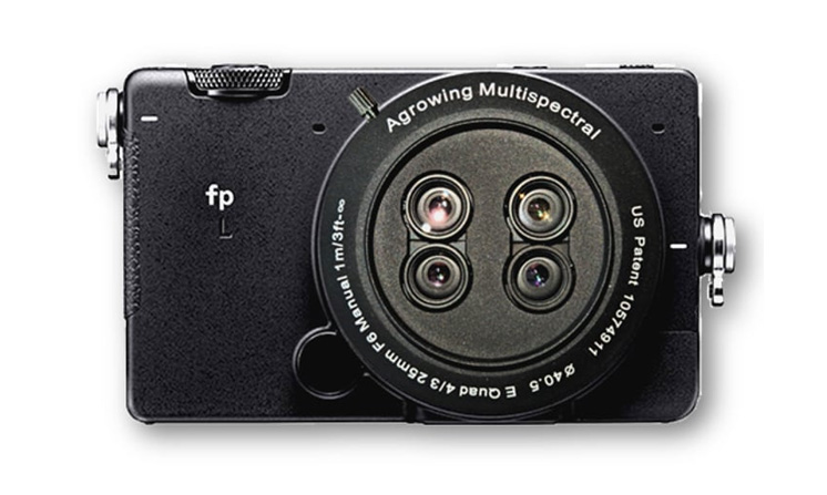
QUAD SONY Sigma fp L Agrowing
Features a 4-lens E-mount, the Sigma Quad can instantly generate 12 bands of 8 to 12 Megapixels per shot: 405nm-430nm-450nm-480nm-510nm-530nm-550nm-570nm-650nm-685nm-710nm-850nm.
The kit includes a carrying case, the SONY Sigma camera, an IR cut filter for camera classic RVB reuse, the E-mount Quad multispectral lens, a maintenance kit, SD card and operating software.
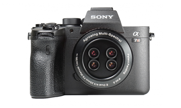
Features a 4-lens E-mount, the A7R Quad can instantly generate 12 bands of 8 to 12 Megapixels (depending with the A7R version) per shot: 405nm-430nm-450nm-480nm-510nm-530nm-550nm-570nm-650nm-685nm-710nm-850nm.
The kit includes a carrying case, the A7R camera, an IR cut filter for camera classic RVB reuse, the E-mount Quad multispectral lens, a maintenance kit, SD card and operating software.
GSD (100m AGL): 1.5cm
Spectral channels: 12
Sensor resolution: 61Mp
Resolution per channel: 12Mp
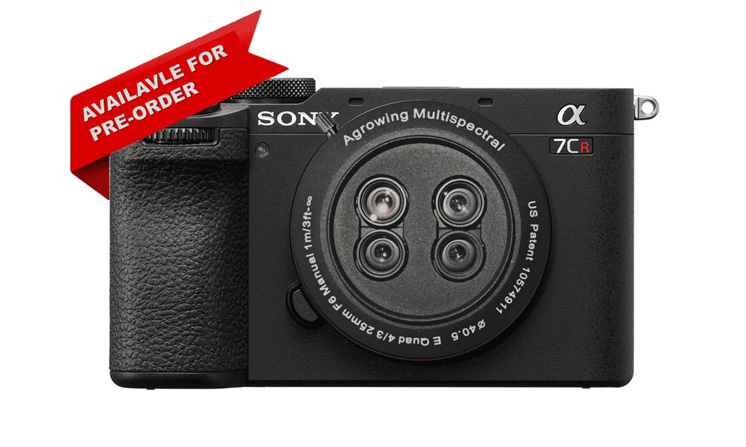
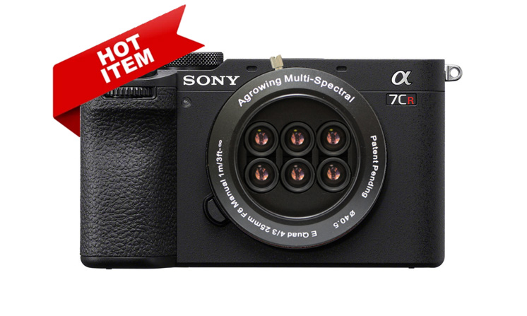
QUAD SONY A7CR Agrowing
Features a 4-lens E-mount, the A7CR Quad can instantly generate 12 bands of 8 to 12 Megapixels per shot: 405nm-430nm-450nm-480nm-510nm-530nm-550nm-570nm-650nm-685nm-710nm-850nm.
The kit includes a carrying case, the SONY A7CR camera, an IR cut filter for camera classic RVB reuse, the E-mount Quad multispectral lens, a maintenance kit, SD card and operating software.
GSD (100m AGL): 1.5cm
Spectral channels: 12
Sensor resolution: 61Mp
Resolution per channel: 12Mp
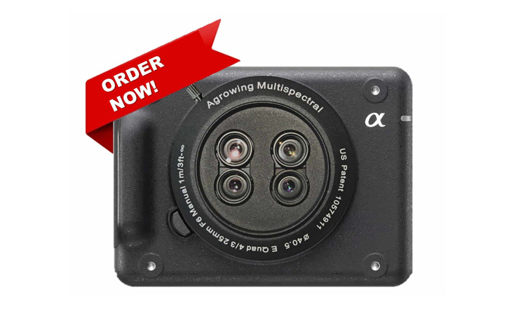
Lightweight ILX-LR1 Agrowing
Features a 4-lens E-mount, the LR1 Quad can instantly generate 12 bands of 8 to 12 Megapixels per shot: 405nm-430nm-450nm-480nm-510nm-530nm-550nm-570nm-650nm-685nm-710nm-850nm.
The kit includes a carrying case, the SONY ILX-LR1 camera, an IR cut filter for camera classic RVB reuse, the E-mount Quad multispectral lens, a maintenance kit, SD card and operating software.
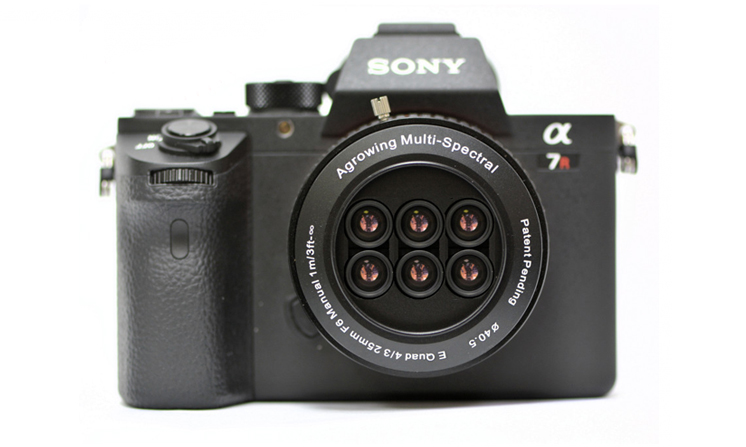
Features a 6-lens E-mount, the A7RIV Sextuple can instantly generate 14 bands of 8 Megapixels per shot: 405nm-430nm-450nm-490nm-525nm-550nm-560nm-570nm-630nm-650nm-686nm-710nm-735nm-850nm.
The kit includes a carrying case, the A7R4 camera, an IR cut filter for camera classic RVB reuse, the E-mount Quad multispectral lens, a maintenance kit, SD card and operating software.
GSD (100m AGL): 1.7cm
Spectral channels: 14
Sensor resolution: 61Mp
Resolution per channel: 8Mp
SEXTUPLE SONY A7CR Agrowing
Features a 6-lens E-mount, the A7CR Sextuple can instantly generate 14 bands of 8 Megapixels per shot: 405nm-430nm-450nm-490nm-525nm-550nm-560nm-570nm-630nm-650nm-686nm-710nm-735nm-850nm.
The kit includes a carrying case, the A7CR camera, an IR cut filter for camera classic RVB reuse, the E-mount Quad multispectral lens, a maintenance kit, SD card and operating software.
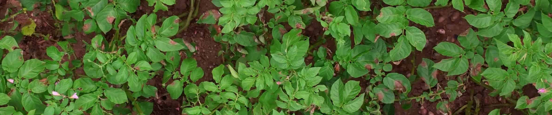
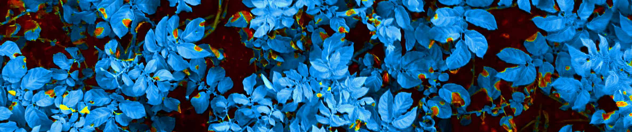
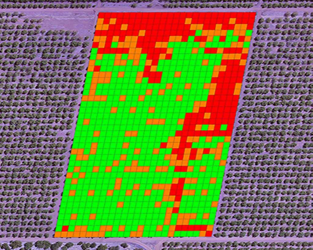
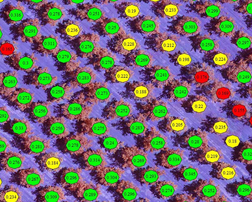
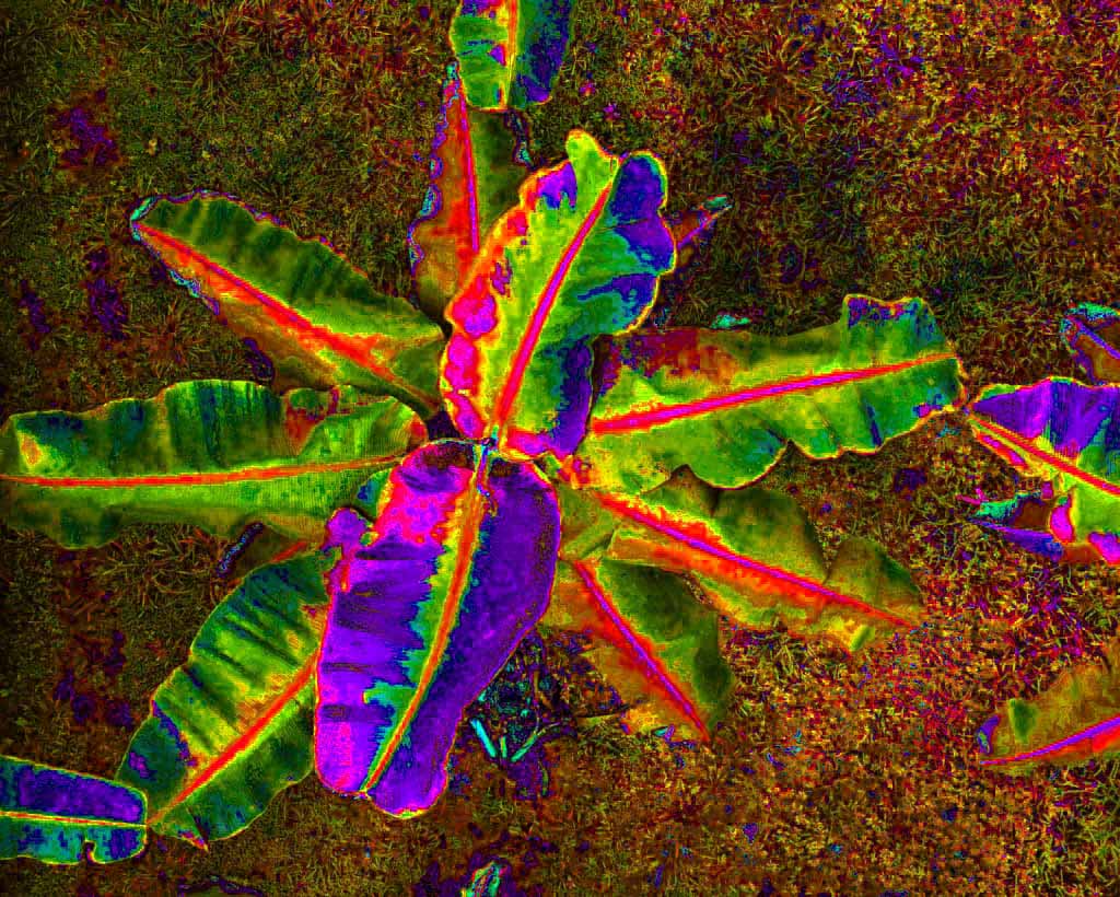
Experts in digital imagery, Drones Imaging can train you in processing and remote sensing. Especially to the near infrared management and analysis in order to build NDVI maps (and other indexes). See our one-day training.