Skip to content
Services et traitements des images aériennes
Twitter Facebook Linkedin
  • Français
  • English
DRONES IMAGING
  • Drones imaging
    • Who are we
  • images processing service
    • topographic service
    • thermographic service
    • agricultural service
    • automatic counting service
    • Use case
    • Product sheets
    • useful documentation
    • download guide
  • Trainings
    • training in photogrammetry metashape option
    • training in photogrammetry Pix4D option
    • Multispectral training
    • online photogrammetry training
  • Softwares
    • Agisoft Metashape photogrammetry software
    • RealityCapture photogrammetry software
    • Undet software
  • RTK Receivers
    • EMLID GNSS RTK Reach RS2+
    • Emlid GNSS RTK Reach RX
    • EMLID GNSS RTK Reach RS+
  • Sensors
    • Agrowing Multispectral cameras
  • News
  • Contact us
Menu Close
  • Drones imaging
    • Who are we
  • images processing service
    • topographic service
    • thermographic service
    • agricultural service
    • automatic counting service
    • Use case
    • Product sheets
    • useful documentation
    • download guide
  • Trainings
    • training in photogrammetry metashape option
    • training in photogrammetry Pix4D option
    • Multispectral training
    • online photogrammetry training
  • Softwares
    • Agisoft Metashape photogrammetry software
    • RealityCapture photogrammetry software
    • Undet software
  • RTK Receivers
    • EMLID GNSS RTK Reach RS2+
    • Emlid GNSS RTK Reach RX
    • EMLID GNSS RTK Reach RS+
  • Sensors
    • Agrowing Multispectral cameras
  • News
  • Contact us

Multispectral training

    Multispectral training
multispectral training

Expert in multispectral remote sensing, discover our day training applied to precision farming.

The strong point of our training: from digital imagery and remote sensing theoretical courses but also numerous practical works with infrared data sets, build your first vegetation health maps (NDVI) and analyze it.

Discover full potential of near infrared by studying and monitoring vegetation health

NDVI multispectrale

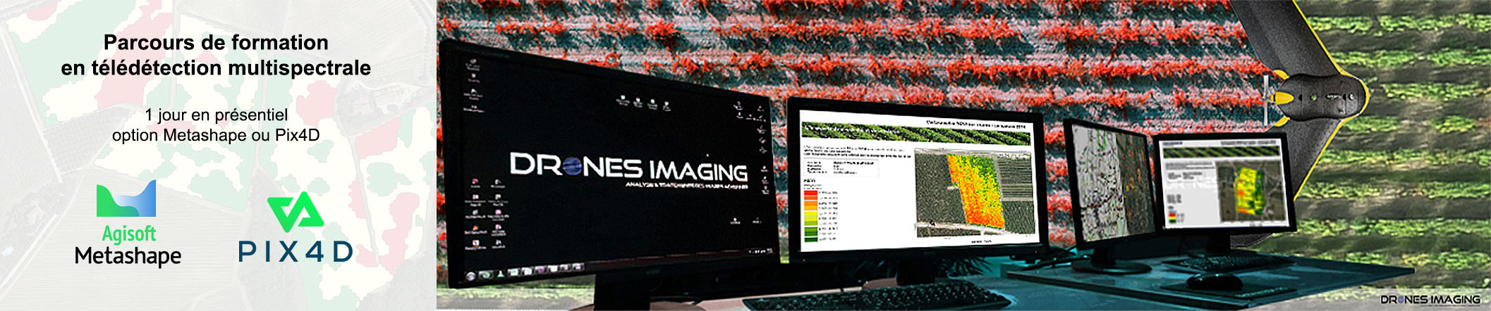
This training is given over an 8-hour day in face-to-face and take place by alternating theoretical courses and practical work:

1-Introduction to remote sensing applied to farming in the visible spectrum and the near infrared. Principles of digital imagery recording and coding.

2-Multispectral sensor operation and presentation of main sensors on the market (advantages and disadvantages).

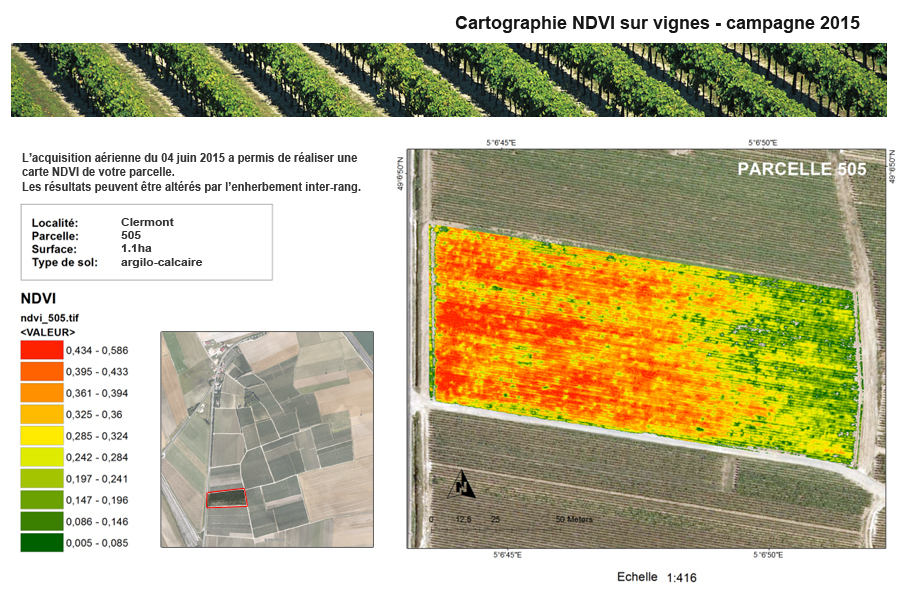
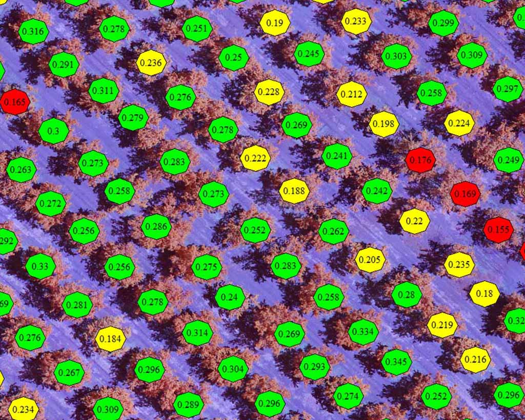
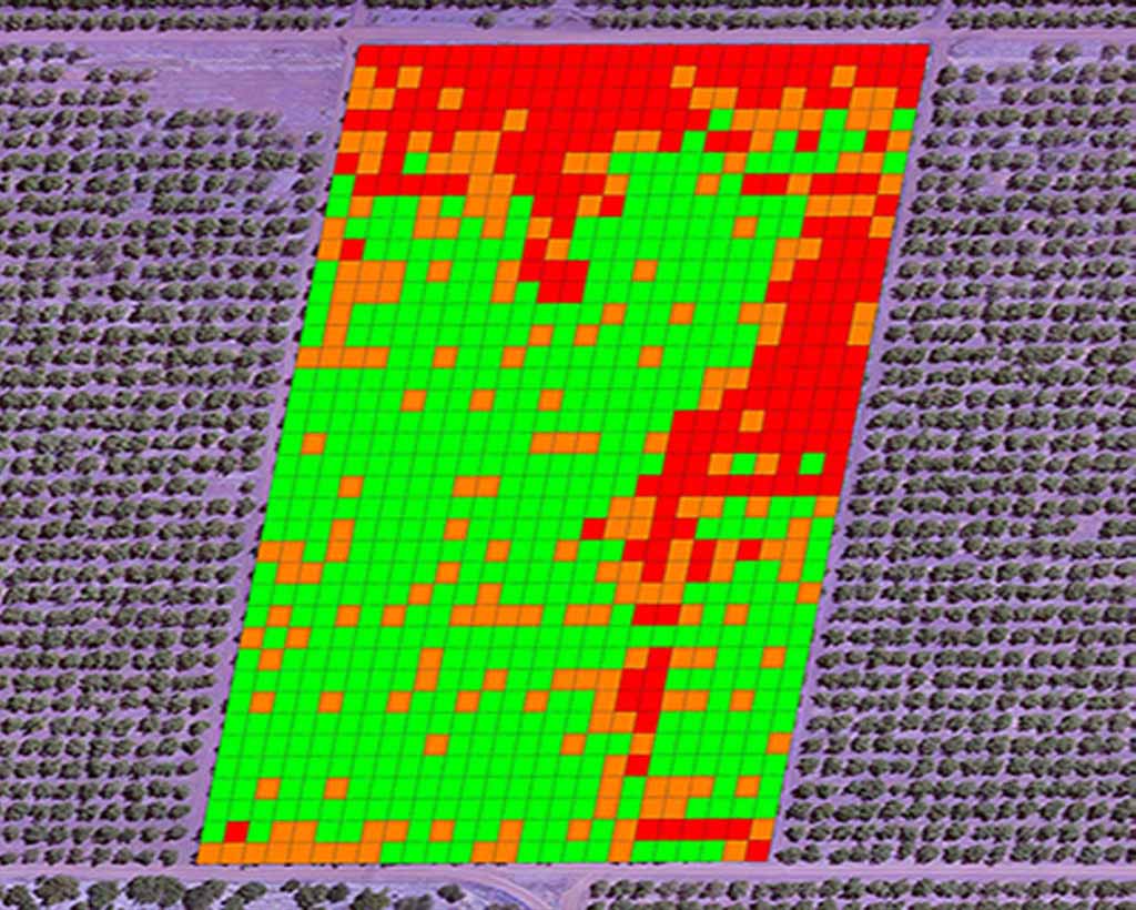
3-Presentation and calculation of the NDVI index, building vegetation activity maps from different softwares (including open source). Study of alteration factors and pitfalls to avoid during flight phases.

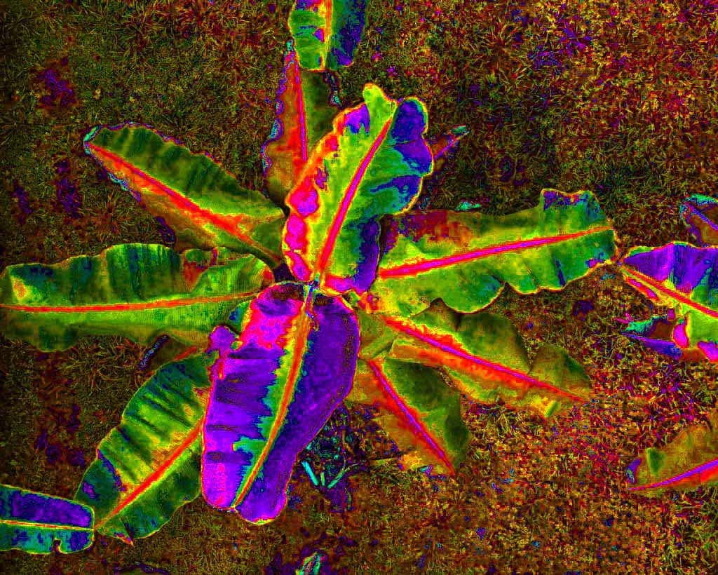
4-Multispectral orthophoto analyzes through NDVI index (and other custom indexes). Zonal classifications & plant segmentations.

Educational content

  • Objectives: Acquire the essential knowledge to make your first chlorophyll activity maps (NDVI) or others (from personalized indexes).
  • Candidates: any learners with know-how in photogrammetry and whose activity (current or future) is oriented towards terrestrial or aerial study of vegetation.
  • Prerequisites: photogrammetry basic knowledge.
  • Hardware: a dual-screen PC specially configured for photogrammetry (I7 processor and 64GB RAM) is assigned to each learner during the training. A multispectral/near infrared sensor is also available to each student.
  • Duration: 08 hours face-to-face.
  • See more about our training schedule.
  • Attendance rate: 100%
  • Training cost: 790€
  • Contact

NDVI - Chlorophyll activity

Target classification

Zonal classification

For any information about our multispectral remote sensing training, contact us

Schedule of our sessions

They chose our training center

cerema
cirad
GE
eplefpa
Ifao
Changins
Terres inovia
  • Mentions légales
  • FrançaisFrançais
  • EnglishEnglish