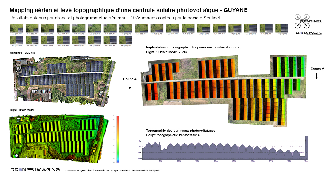
Topographical survey of a solar power plant in French Guyana
Topographical survey of a solar power plant and visual inspection of the photovoltaic panels. Results obtained from 1975 aerial photos taken by Sentinel. Post-processing and data analysis by Drones Imaging.
Orthophoto and Digital Surface Model

3D visualization of the solar farm
Topographic survey carried out by aerial photogrammetry and delivered in the form of an orthophoto + dense cloud. Compatible with Autocad, this geospatial data are using to elaborate a topographic and legal plan of the site. The very high resolution orthomosaic also allowed visual inspection of each panel.
TECHNICAL INFORMATIONS
- Aerial imagery post-processing service : Drones Imaging company.
- Aerial imagery capture : Sentinel company.
- Spatial accuracy : centimeter.
- Orthophoto RVB : GSD 5mm.
- Inspected area : 10ha.
- Photogrammetry software : Agisoft Metashape.
- Export formats : GéoTiff and Dwg autocad.
- Delivery delay : 4 hours.
- Use case taught during our photogrammetry training : see more.
