Skip to content
Services et traitements des images aériennes
Twitter Facebook Linkedin
  • Français
  • English
DRONES IMAGING
  • Drones imaging
    • Who are we
  • images processing service
    • topographic service
    • thermographic service
    • agricultural service
    • automatic counting service
    • Use case
    • Product sheets
    • useful documentation
    • download guide
  • Trainings
    • training in photogrammetry metashape option
    • training in photogrammetry Pix4D option
    • Multispectral training
    • online photogrammetry training
  • Softwares
    • Agisoft Metashape photogrammetry software
    • RealityCapture photogrammetry software
    • Undet software
  • RTK Receivers
    • EMLID GNSS RTK Reach RS2+
    • Emlid GNSS RTK Reach RX
    • EMLID GNSS RTK Reach RS+
  • Sensors
    • Agrowing Multispectral cameras
  • News
  • Contact us
Menu Close
  • Drones imaging
    • Who are we
  • images processing service
    • topographic service
    • thermographic service
    • agricultural service
    • automatic counting service
    • Use case
    • Product sheets
    • useful documentation
    • download guide
  • Trainings
    • training in photogrammetry metashape option
    • training in photogrammetry Pix4D option
    • Multispectral training
    • online photogrammetry training
  • Softwares
    • Agisoft Metashape photogrammetry software
    • RealityCapture photogrammetry software
    • Undet software
  • RTK Receivers
    • EMLID GNSS RTK Reach RS2+
    • Emlid GNSS RTK Reach RX
    • EMLID GNSS RTK Reach RS+
  • Sensors
    • Agrowing Multispectral cameras
  • News
  • Contact us

Blog

    News   Thermal inspection by photogrammetry – Paris City Hall.

Thermal inspection by photogrammetry – Paris City Hall.

  • December 16, 2016
  • 1:40 pm

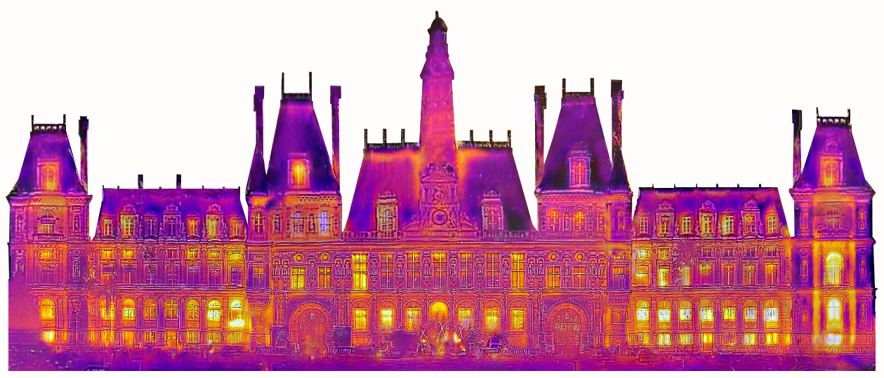
Thermal orthophoto of the Paris town hall

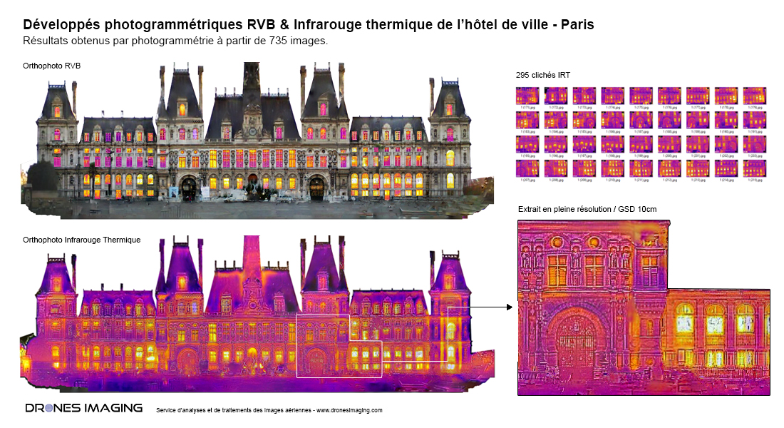
Thermal orthophoto of the west facade of the Paris town hall. Thermal and RGB images recording on December 15, 2016 in the 07:00 – 08:00 time slot.

Orthophoto RVB et radiométrique de la mairie de Paris

Orthophoto thermique

Before / After - Thermal / RVB

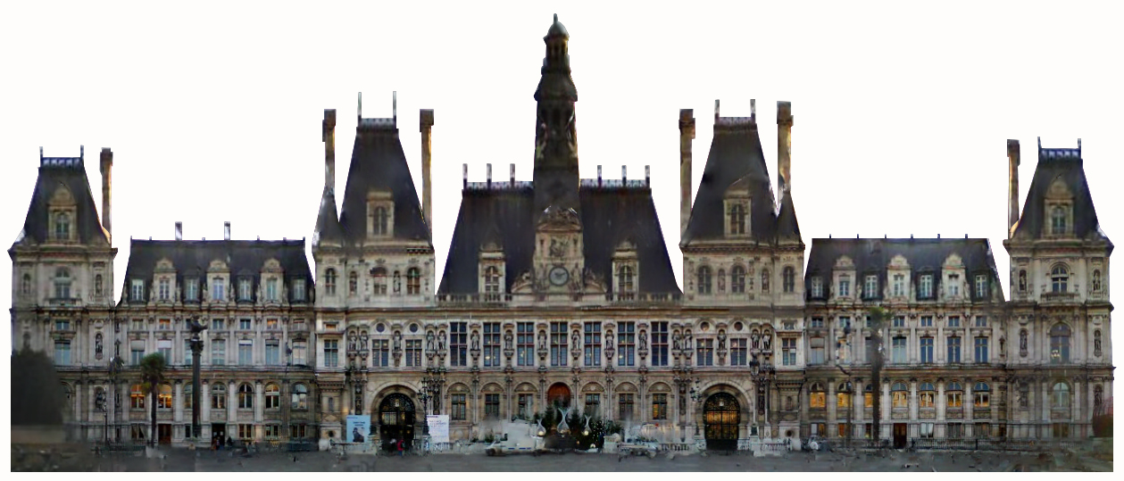
Above, orthophotos of the west facade of the Paris town hall built from 295 IRT (thermal infrared) and 440 RGB images. Experimentation aimed at qualifying the good photogrammetric restitution from a terrestrial capture and subsequently, accuracy of the temperatures measured on the final radiometric orthophoto.

TECHNICAL INFORMATIONS

  • Thermal imagery analysis and processing service : Drones Imaging company.
  • Terrestrial images capture : Drones Imaging company.
  • Spatial accuracy : decimetric by scaling from quotations taken with a laser rangefinder.
  • Infrared thermal orthophoto : GSD 3cm.
  • RVB orthophoto : GSD 3cm.
  • Front length : 145m.
  • Sensor : Thermal infrared FLIR C2.
  • Photogrammetry software : Agisoft Metashape.
  • Export formats : GéoTiff and Dwg autocad.
  • Delivery delay : 24 hours.
  • Use case taught during our photogrammetry training  : see more.
PrevPrécédentAerial mapping and topographic survey of a photovoltaic power plant – French Guiana.
SuivantBridge inspection by photogrammetryNext
  • Mentions légales
  • FrançaisFrançais
  • EnglishEnglish