Lettuces automatic counting by drone and machine learning geomatics June 24, 2021 Automatic counting plants by drone from multispectral orthophoto Automatic counting carried out by machine learning and subsequently, NDVI classification Continuer la lecture
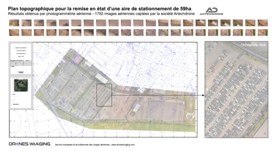
Survey map of a parking area built by... geomatics June 10, 2021 Autocad road plan of a parking area produced by drone and aerial photogrammetry. Standardizes autocad road plan of a Continuer la lecture