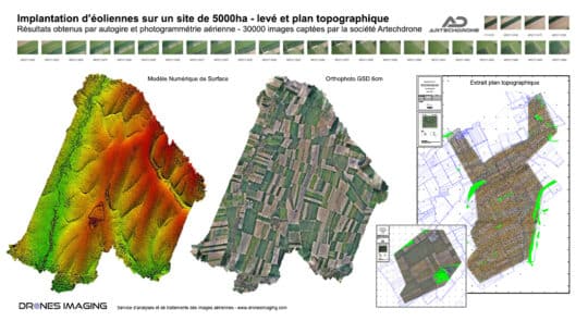
Topographic survey carried out by gyrocopter geomatics July 16, 2021 Topographic survey of 5000ha carried out by gyrocopter and aerial photogrammetry. Autocad topographic plans made from MNS and orthophoto Continuer la lecture
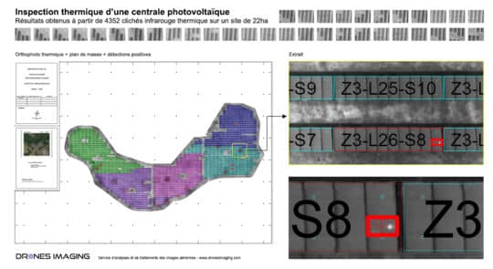
Inspection of a photovoltaic power plant carried out... geomatics July 13, 2021 Thermographic inspection of a photovoltaic power plant Results obtained from 4352 aerial images taken by Tech Drone Service company. Continuer la lecture
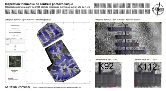
Thermal inspection of a photovoltaic power plant carried... geomatics July 12, 2021 Thermal inspection of a photovoltaic power plant carried out by drone and aerial photogrammetry Résults obtained from 23135 aerial Continuer la lecture
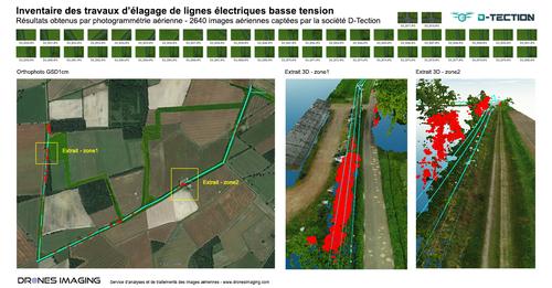
High voltage lines inspection: cable extraction and 3D... geomatics July 6, 2021 3D modeling of electrical cables in the form of 3D polylines for vegetation management under power lines Results obtained Continuer la lecture
Lettuces automatic counting by drone and machine learning geomatics June 24, 2021 Automatic counting plants by drone from multispectral orthophoto Automatic counting carried out by machine learning and subsequently, NDVI classification Continuer la lecture
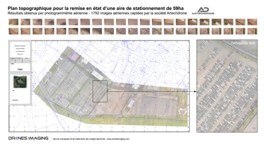
Survey map of a parking area built by... geomatics June 10, 2021 Autocad road plan of a parking area produced by drone and aerial photogrammetry. Standardizes autocad road plan of a Continuer la lecture
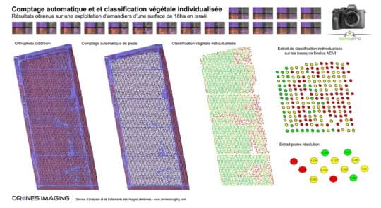
Agrowing multispectral camera – automatic counting and almonds... geomatics May 12, 2021 Automatic counting by deep learning. Results obtained from 155 multispectral images taken by drone over a 18ha area. Automatic Continuer la lecture
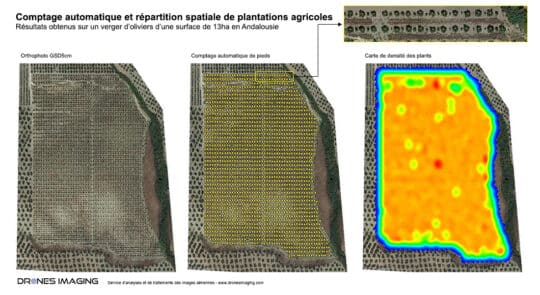
Machine learning – automatic counting and spatial distribution... geomatics March 30, 2021 Automatic objects detection & extraction by machine learning Counting by machine learning, results obtained from a drone on a Continuer la lecture
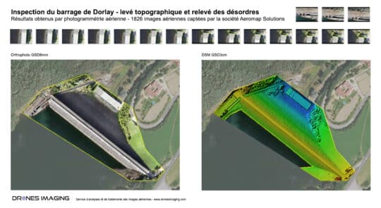
Dam inspection – Topographic survey and disorders detection... geomatics March 1, 2021 Dam inspection carried out by drone and photogrammetry. Results obtained from 1826 aerial images over a 4840m² area. Defects Continuer la lecture