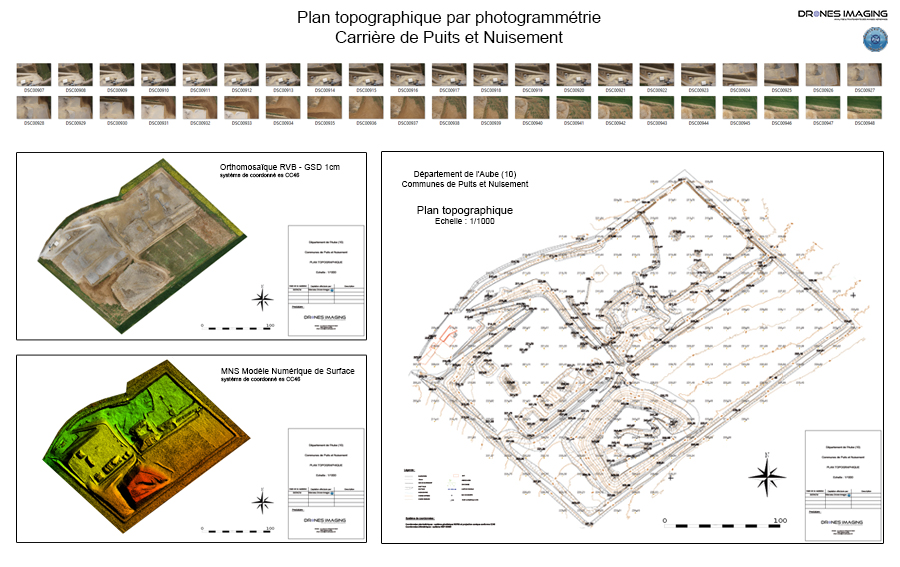
Survey plan and volumetry
Survey plan and volumetry of the Puits et Nuisements quarry. Results obtained from 740 aerial images captured by Marceau Drone Images, post-processing and image analysis by Drones Imaging.
Quarry survey and volume analysis
Pierre Marceau, director of the Marceau Drones Images company, received operational technical training (photogrammetry option) with our partner Flying Eye.
Less than a week after his professional training and on the order of a firm of surveyors, he applied his skills on two quarries. After sending us his images, we were able to quickly carry out the post-processing work to deliver him afterwards: two topographic plans and stocks analysis, an example of which is shown above.
A fine job summarizing quality training, rigorous application of the operating methods taught (including GPS RTK implantation) and our post-processing service. Now able to market successful and high value-added products for the benefit of surveyors, we are delighted to continue this collaboration with Marceau Drones Images in the field of the mining industry.
TECHNICAL INFORMATIONS
- Mining industry post-processing service : Drones Imaging company.
- Flights and aerial imagery : Marceau Drone Images company.
- Spatial accuracy : centimeter.
- Orthophoto RVB : GSD 1cm.
- Covered area : 12ha.
- Drone : Mikrokopter.
- Camera : Sony A6000.
- Photogrammetry software : Agisoft Metashape.
- Geographic Information System : Autocad Covadis.
- Partly taught in training : see more.