Automatic Detection and Localization of Coconut Trees Using Agisoft Metashape Software
Automated coconut tree counting on a 300ha area: results obtained through aerial photogrammetry and Deep Learning. Post-processing and image analysis by Drones Imaging.
In the vast coconut plantation in Kolovai, Tonga, conducting a census and assessing the health status of the trees would pose a daunting task, requiring a substantial investment of time and labor. To simplify and expedite this intricate process, the use of a Deep Learning model within the Agisoft Metashape software has proven to be an innovative solution. This model facilitates the automated detection and localization of each coconut tree. Furthermore, this work can be further enriched by subsequently assessing the health status of the plants, measuring parameters such as the height of each trunk or the NDVI (Normalized Difference Vegetation Index) value based on the chlorophyll metabolism of each vegetative cover—all achieved in a fully automated manner.
In this context, a 300-hectare orthophoto of the Kolovai site in Tonga was utilized for an automatic coconut tree count, thereby combining the power of deep learning with the performance capabilities of Agisoft Metashape.
Automated coconut tree counting in Kolovai
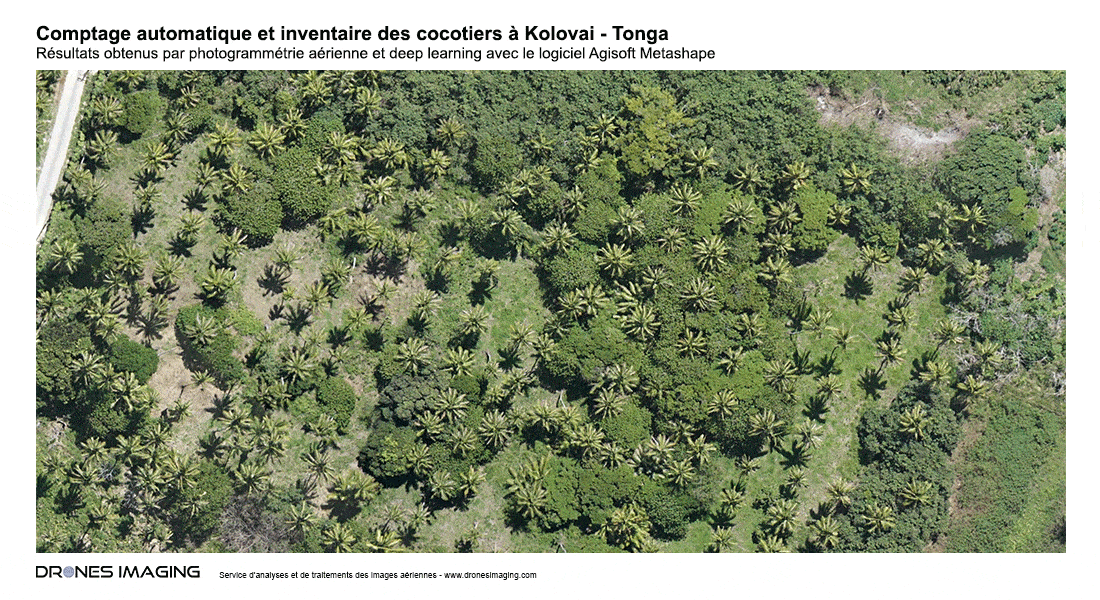
The obtained results were remarkable: more than 12,000 coconut trees were accurately counted and located in less than 20 minutes. This technological advancement now provides a rapid and precise alternative to traditional counting methods that require intensive manual efforts.
In addition to the tree count, the location information provided by this approach enables more efficient management of natural resources. Environmental authorities can now better understand the distribution of plantations, facilitating the management of land and harvests
TECHNICAL INFORMATIONS
- Automatic counting service : Drones Imaging company.
- Flights and aerial capture : Cristiano Giovando.
- Spatial accuracy : centimetric.
- Image resolution : 6cm GSD.
- Covered area : 300ha.
- Number of plants counted: >12000.
- Drone : DJI p4p.
- Photogrammetry software : Agisoft Metashape.