Skip to content
Services et traitements des images aériennes
Twitter Facebook Linkedin
  • Français
  • English
DRONES IMAGING
  • Drones imaging
    • Who are we
  • images processing service
    • topographic service
    • thermographic service
    • agricultural service
    • automatic counting service
    • Use case
    • Product sheets
    • useful documentation
    • download guide
  • Trainings
    • training in photogrammetry metashape option
    • training in photogrammetry Pix4D option
    • Multispectral training
    • online photogrammetry training
  • Softwares
    • Agisoft Metashape photogrammetry software
    • Undet software
  • RTK Receivers
    • EMLID GNSS RTK Reach RS3
    • EMLID GNSS RTK Reach RS2+
    • Emlid GNSS RTK Reach RX
    • EMLID GNSS RTK Reach RS+
  • Sensors
    • Agrowing Multispectral cameras
  • News
  • Contact us
  • Toggle website search
Menu Close
  • Drones imaging
    • Who are we
  • images processing service
    • topographic service
    • thermographic service
    • agricultural service
    • automatic counting service
    • Use case
    • Product sheets
    • useful documentation
    • download guide
  • Trainings
    • training in photogrammetry metashape option
    • training in photogrammetry Pix4D option
    • Multispectral training
    • online photogrammetry training
  • Softwares
    • Agisoft Metashape photogrammetry software
    • Undet software
  • RTK Receivers
    • EMLID GNSS RTK Reach RS3
    • EMLID GNSS RTK Reach RS2+
    • Emlid GNSS RTK Reach RX
    • EMLID GNSS RTK Reach RS+
  • Sensors
    • Agrowing Multispectral cameras
  • News
  • Contact us
  • Toggle website search

Blog

  1. Home>
  2. geomatics>
  3. Topographic map of a tourist complex in Corsica

Topographic map of a tourist complex in Corsica

  • July 25, 2022
  • 1:33 pm

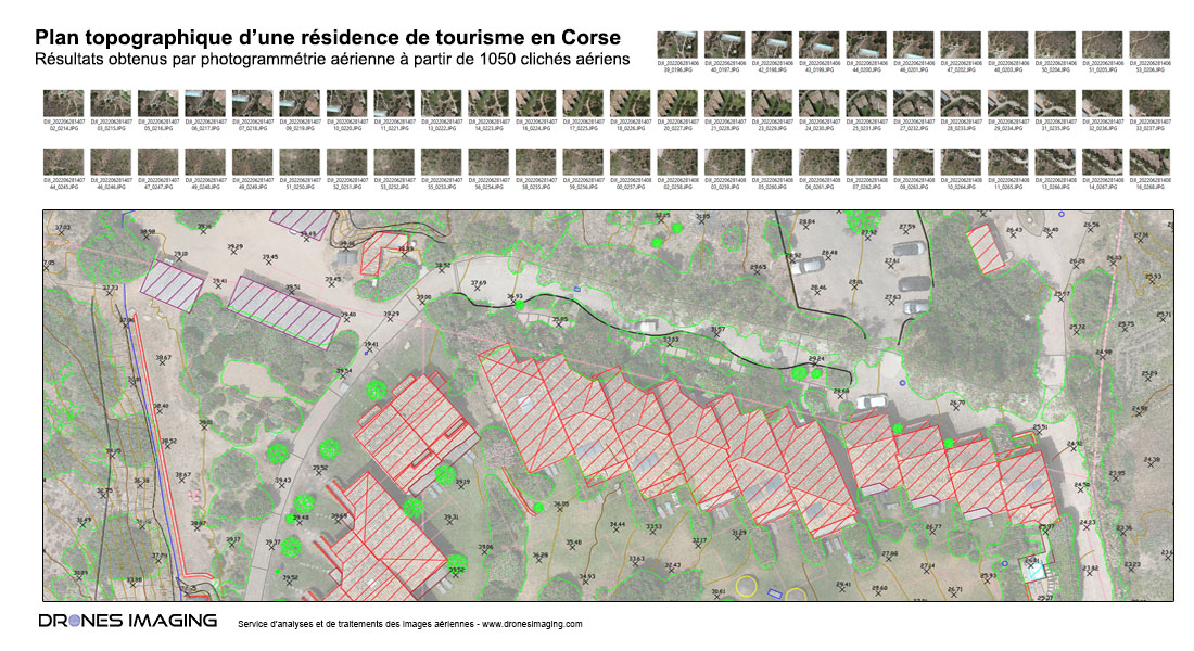
Autocad plan built by photogrammetry from aerial images.

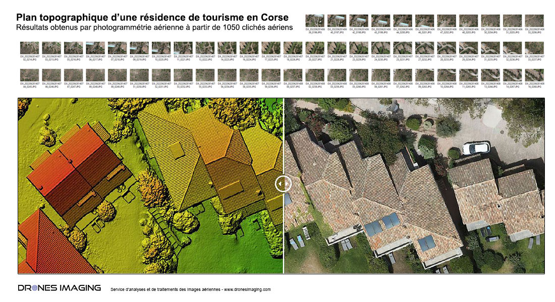
Results obtained from 1050 aerial images over a 5ha total area

Orthophoto and Digital Surface Model

Orthophoto et DSM

Extract from the Autocad plan in DWG format

Plan autocad photogrammétrie

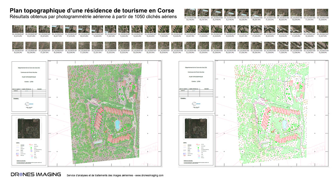
Entire tourist complex finalized plan

Plan topographique autocad

Above, the orthophoto with a 7mm GSD made from L1 images (DJI M300 drone) taken by the company I-Techdrone.

A current technical service combining the know-how of the photogrammetrist and the draftsman to ultimately, produce plans with high added value and entirely carried out remotely, in our design office (without technical/weather nuisance in situ).

TECHNICAL INFORMATIONS

  • Data processing service : Drones Imaging company
  • Aerial Images Source : I-Techdrone company
  • Spatial accuracy : centimeter with EMLID Reach RS2.
  • Orthophoto RVB : 7mm GSD.
  • Covered area : 5ha
  • Drone : DJI M300
  • Photogrammetry software : Metashape
PrevPrécédentStudy of light pollution for energy waste and enhancement of the nocturnal landscape
SuivantComplex roof survey carried out by droneNext
  • Mentions légales
  • Français
  • English