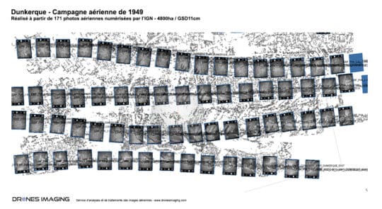
Historical orthophoto of the Dunkirk city in 1949 geomatics October 8, 2019 Historical orthophoto of the Dunkirk city in 1949 Historical orthophoto of Dunkirk built for the observation of the territory Continuer la lecture
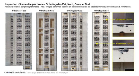
Facade inspection by drone and aerial photogrammetry geomatics September 17, 2019 Facade inspection by drone and aerial photogrammetry Facade inspection by drone: results obtained from 3500 aerial images as part Continuer la lecture
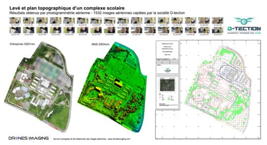
Autocad map of a school complex built by... geomatics July 25, 2019 Autocad map of a 10ha area built from orthophoto and classified Digital Surface Model. Autocad map, July 2019 – Continuer la lecture
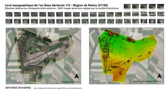
Long range photogrammetry by gyroplane – Topographic survey... geomatics March 19, 2019 Topographic survey of 1100 hectares carried out by aerial photogrammetry Aerial photogrammetry by gyroplane: results obtained from 2600 aerial Continuer la lecture
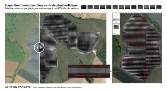
Thermal inspection of photovoltaic panels geomatics March 7, 2019 Thermal inspection of solar panels – Detection and localization of hotspot heating for yield losses evaluation. Thermal inspection: results Continuer la lecture
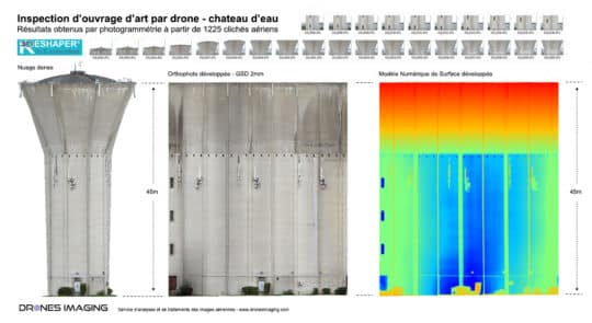
Water tower inspection by drone – surface analysis geomatics January 23, 2019 Water tower inspection by drone and aerial photogrammetry Water tower inspection: results obtained from 1225 aerial images taken by Continuer la lecture
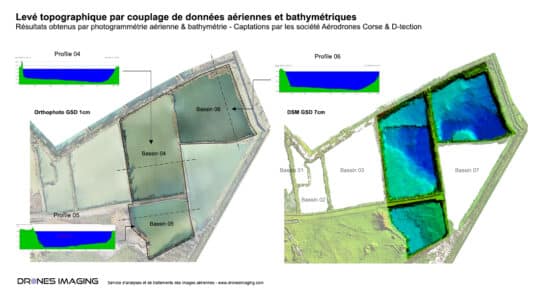
Topographic and bathymetric survey by drone in Corsica geomatics January 9, 2019 Bathymetry and aerial photogrammetry over a 55ha quarry Bathymetry and aerial photogrammetry: results obtained from 740 aerial images taken Continuer la lecture