Dam auscultation by drone, crack detection, and monitoring of the structure over time
Dam inspection by drone: results obtained from 1350 aerial shots captured by Sentinel company in French Guiana. Post-processing and image analysis by Drones Imaging.
Inspection of hydroelectric dams is a crucial task to ensure the safety of people and property nearby. Dams are often subjected to extreme environmental conditions and may suffer structural damage, which requires regular monitoring.
Drones are increasingly being used to perform dam inspections as they can reach difficult-to-access areas, such as remote zones or the upper parts of the structure, without compromising the safety of inspectors. In this classic auscultation service where detailed search and image sharpness are essential, the DJI M300 drone is the ideal vector, given its high-resolution P1 sensor and its ability to fly in automatic mode with an accuracy of about 10cm, allowing it to maintain a constant shooting distance from the walls with very complex circular shapes on all three axes. See illustration below:
Dam inspection by drone in automated flight mode.
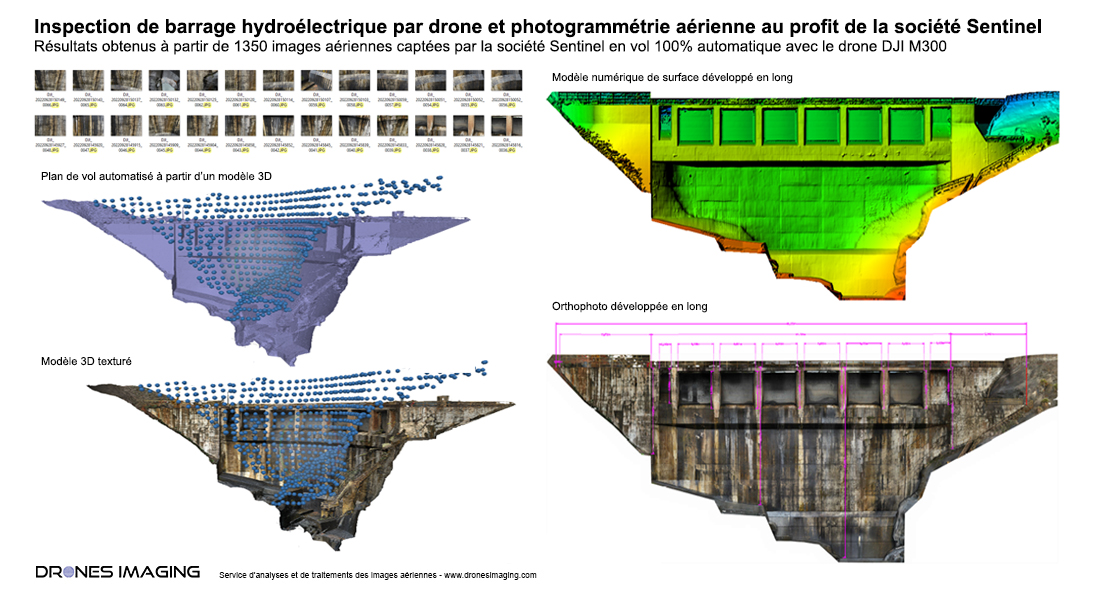
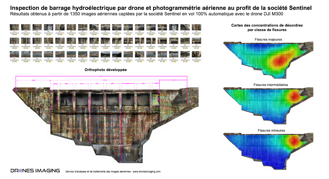
Thus, the high-resolution P1 camera (full-frame sensor / 45Mpx) on the DJI M300 drone allows for the visualization of the finest details of the structure, such as submillimetric cracks. Moreover, the automated flight program, which is the same for each recurrent inspection, allows engineers to monitor risk zones more frequently and assess the structural evolution of the structure over time. This significantly reduces the costs of traditional non-robotic interventions. Below are the results obtained through photogrammetry with Agisoft Metashape software and subsequently analyzed with the ESRI suite to locate the stress zones of the dam where disorder densities are highest.
Detection of disorders and localization of major stress zones
TECHNICAL INFORMATIONS
- Aerial images processing and analysis service : Drones Imaging company.
- Aerial flights and capture : Sentinel company.
- Spatial accuracy : Centimetric accuracy from scratch and submillimetric accuracy in relative for recurrent inspections.
- Orthophoto RVB : GSD 0.8mm.
- Total inspected surface area : 1415m².
- Drone : DJI M300.
- Sensor : DJI P1.
- Photogrammetry software : Agisoft Metashape.
- Geographic Information System : ArcGis.
- Taught during our photogrammetry training course : see more.