Skip to content
Services et traitements des images aériennes
Twitter Facebook Linkedin
  • Français
  • English
DRONES IMAGING
  • Drones imaging
    • Who are we
  • images processing service
    • topographic service
    • thermographic service
    • agricultural service
    • automatic counting service
    • Use case
    • Product sheets
    • useful documentation
    • download guide
  • Trainings
    • training in photogrammetry metashape option
    • training in photogrammetry Pix4D option
    • Multispectral training
    • online photogrammetry training
  • Softwares
    • Agisoft Metashape photogrammetry software
    • Undet software
  • RTK Receivers
    • EMLID GNSS RTK Reach RS3
    • EMLID GNSS RTK Reach RS2+
    • Emlid GNSS RTK Reach RX
    • EMLID GNSS RTK Reach RS+
  • Sensors
    • Agrowing Multispectral cameras
  • News
  • Contact us
  • Toggle website search
Menu Close
  • Drones imaging
    • Who are we
  • images processing service
    • topographic service
    • thermographic service
    • agricultural service
    • automatic counting service
    • Use case
    • Product sheets
    • useful documentation
    • download guide
  • Trainings
    • training in photogrammetry metashape option
    • training in photogrammetry Pix4D option
    • Multispectral training
    • online photogrammetry training
  • Softwares
    • Agisoft Metashape photogrammetry software
    • Undet software
  • RTK Receivers
    • EMLID GNSS RTK Reach RS3
    • EMLID GNSS RTK Reach RS2+
    • Emlid GNSS RTK Reach RX
    • EMLID GNSS RTK Reach RS+
  • Sensors
    • Agrowing Multispectral cameras
  • News
  • Contact us
  • Toggle website search

automatic counting service

  1. Home>
  2. automatic counting service

Deep learning service for object detection and counting

From your aerial shots, orthophotos or satellite imagery (RGB or multispectral), Drones Imaging offers you its machine learning service for objects detection and counting such as: plantations, vehicles, superstructures, various defects or any other standardized signatures. Entrust us with your images and we will process them as soon as possible.

Supervised classification

Zonal (area) detections

  • Supervised classification for swimming pool detection (GEOTIFF, DWG, DXF, SHP and other formats).
  • Classification for vegetation percentage (GEOTIFF, DWG, DXF, SHP and other formats).
  • Supervised multi-classification (GEOTIFF, DWG, DXF, SHP and other formats).
  • Supervised classification for hydrographic networks (GEOTIFF, DWG, DXF, SHP formats)
Détection de piscines orthophoto avion
Formats GeoTiff, SHP, DXF, DWG
Classification végétale orthophoto drone
Formats GeoTiff, SHP, DXF, DWG
Multi classification imagerie satellite
Formats GeoTiff, SHP, DXF, DWG
Classification des réseaux hydrographiques
Formats GeoTiff, SHP, DXF, DWG

Deep learning

Point detections (counting)

  • Plantation counting from orthophoto (DWG, DXF, SHP and other formats).
  • Tree counting from orthophoto (DWG, DXF, SHP and other formats).
  • Vehicule counting from image (DWG, DXF, SHP and other formats).
  • Plants counting from multispectral orthophoto (DWG, DXF, SHP and other formats).
Comptage de palmiers orthophoto drone
Formats SHP, DXF, DWG
Comptage de sapins orthophoto drone
Formats SHP, DXF, DWG
Comptage de véhicules image avion
Formats SHP, DXF, DWG
Comptage d'oliviers orthophoto satellite
Formats SHP, DXF, DWG
Comptage de laitues orthophoto multispectrale
Formats SHP, DXF, DWG

Your turnkey deliverables

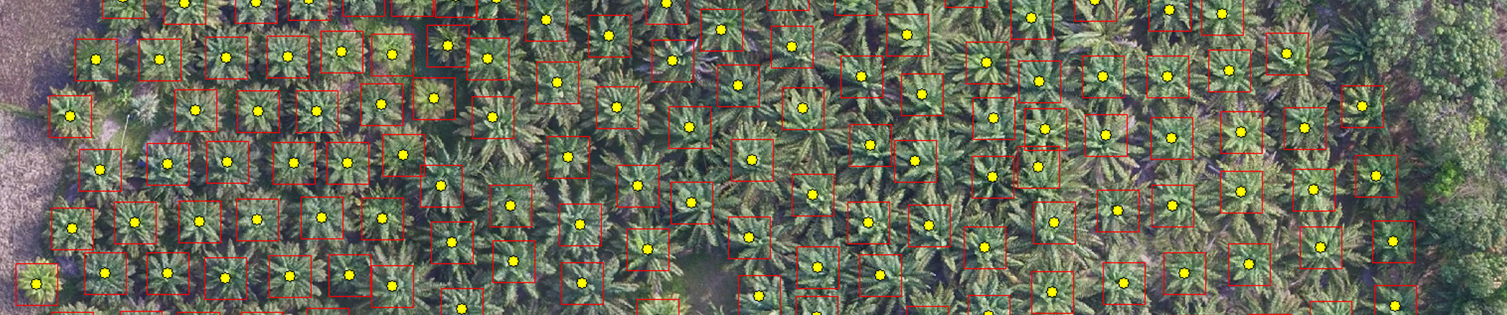
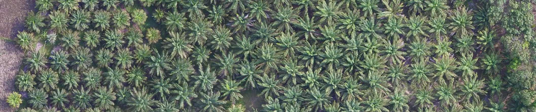
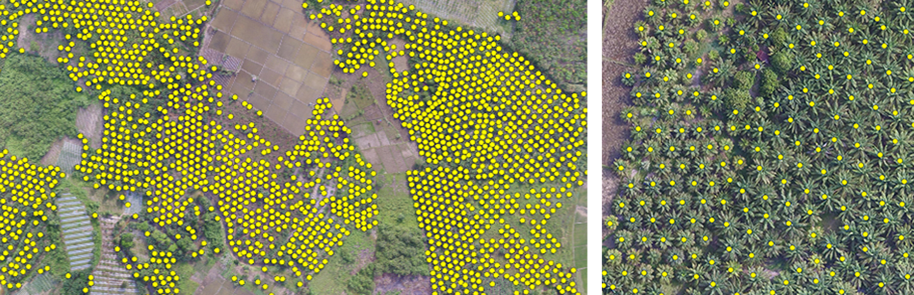
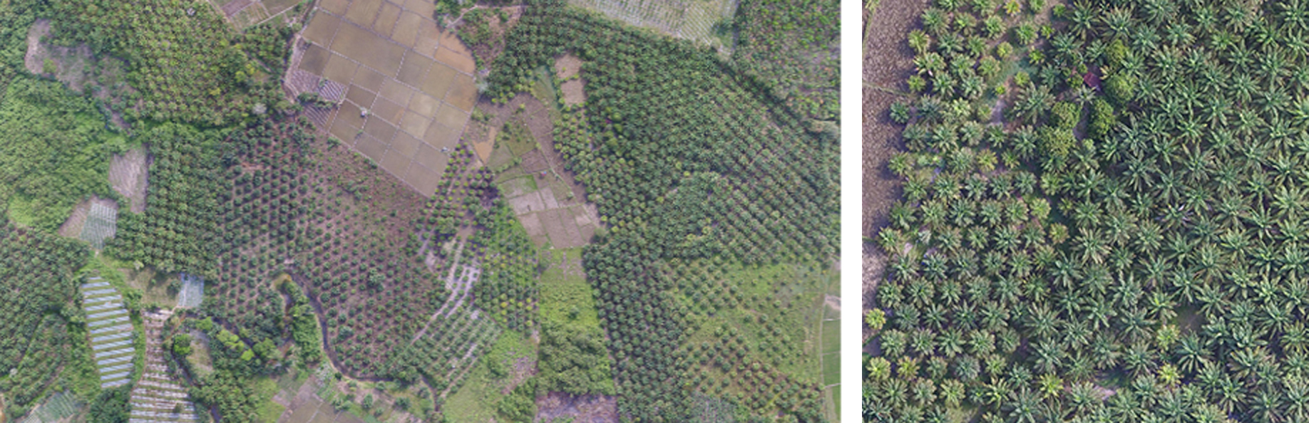
Detection, location and plantations counting with a 50ha plot in Indonesia

5145 palm trees counted on the entire site. Work achievable from your aerial images whose overlaps meet photogrammetry standards. Contact us for more information.

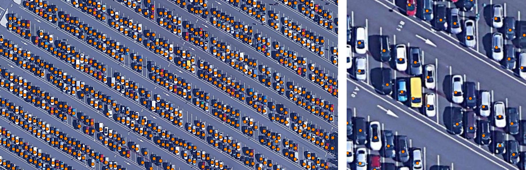
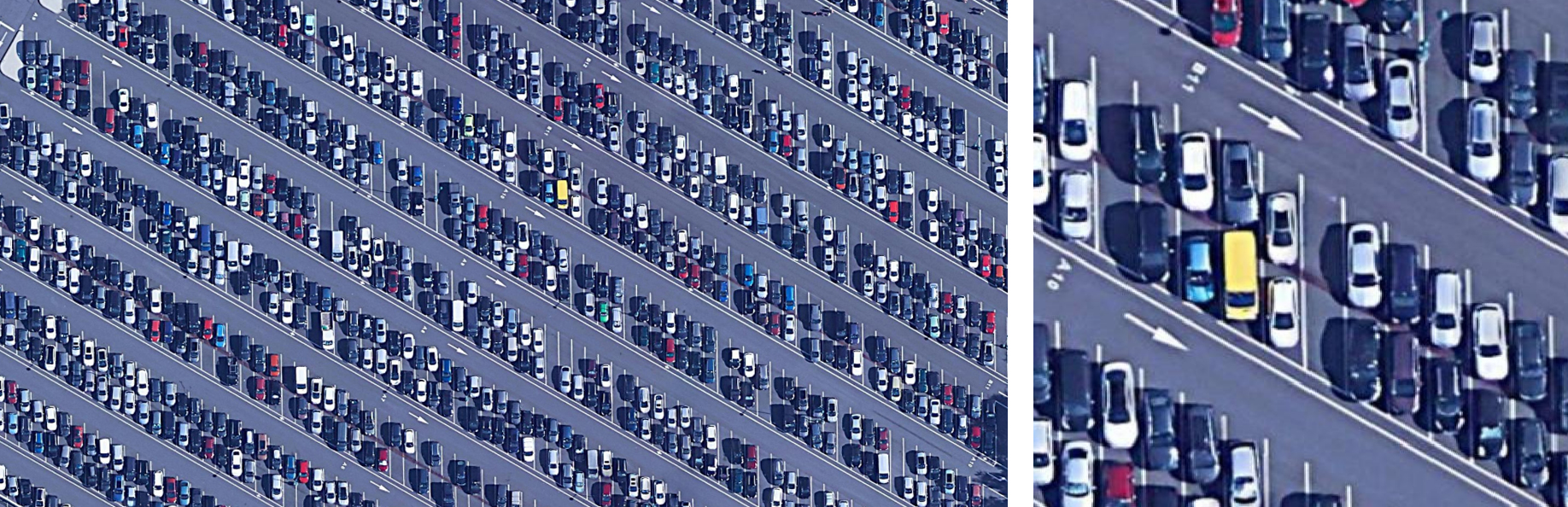
Vehicle count at Disney Land

1235 vehicles counted in the entire car park. Work achievable from your aerial images whose overlaps meet photogrammetry standards. Contact us for more information.

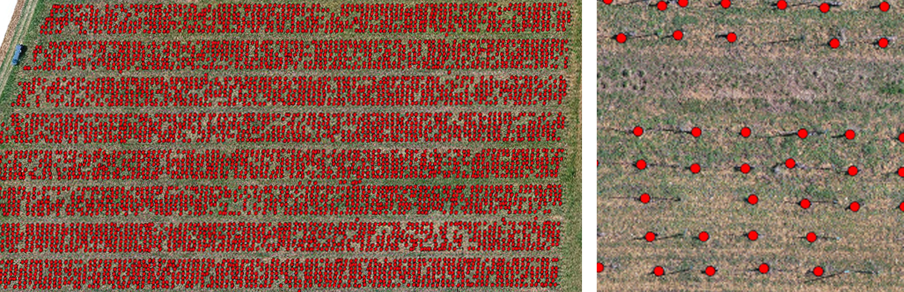
Detection and counting of vine plants with a 2ha plot in Burgundy

In collaboration with D-Tection company, 7660 vines counted and located on the entire plot. Work achievable from your RGB or multispectral aerial images whose overlaps meet photogrammetry standards. Contact us for more information.

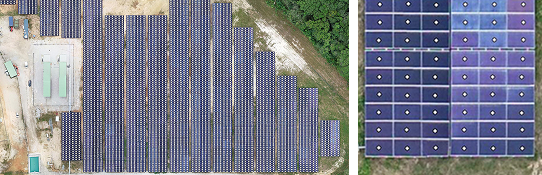
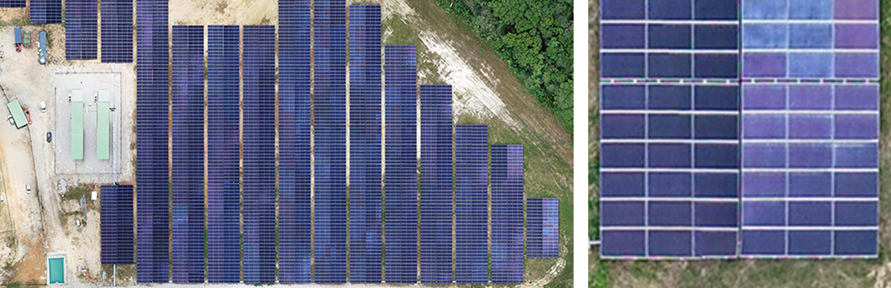
Automatic counting of photovoltaic panels with a solar power plant in French Guiana

In collaboration with Sentinel company, 11,916 solar panels detected and located across the entire site. Work achievable from your aerial shots whose overlaps meet photogrammetry standards. Contact us for more information.

  • Mentions légales
  • Français
  • English