From multiband images taken by drone or any other, Drones Imaging supports you with the imagery processing and analysis. We will thus provide you with readable and processed geospatial data from current or personalized remote sensing indices according to your needs. We will also analyze your productions in order to extract useful data, synthesized through diagnostic and/or damage maps. Entrust us with your images and we will process them as soon as possible.
Multispectral processing
We build your geospatial data
Multiband orthophoto (GeoTIFF format).
NDVI index (GeoTIFF, KMZ, ECW, JPG2000 and other formats).
Biomass (SHP, GeoTiff, KMZ formats).
Bright soil index (GeoTIFF, KMZ, ECW, JPG2000 and other formats).
Grass cover – percentage of vegetation.
Multiband orthophoto
GeoTiff format
NDVI
GeoTiff, Ecw, Kmz formats
Micro-plot biomass
Shp, GeoTiff, Kmz formats
Bright soil index
GeoTiff, Ecw, Kmz formats
Percentage of vegetation
GeoTiff format
Analyzes and diagnostics
We analyze your geospatial data
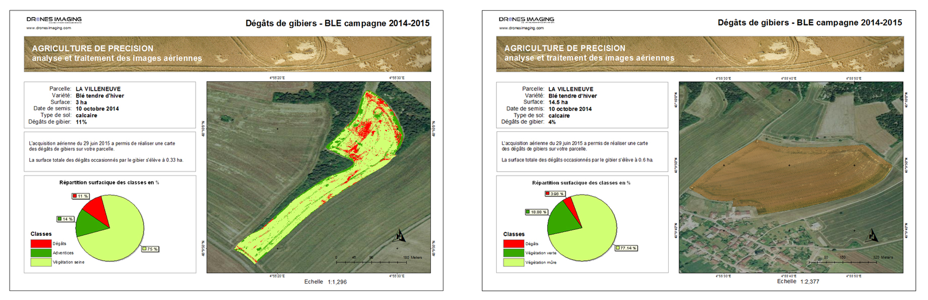
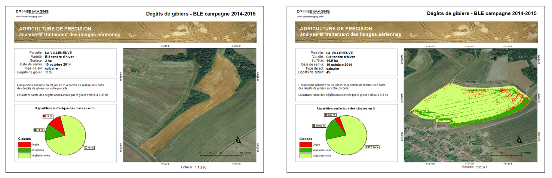
Game damage diagnostics.
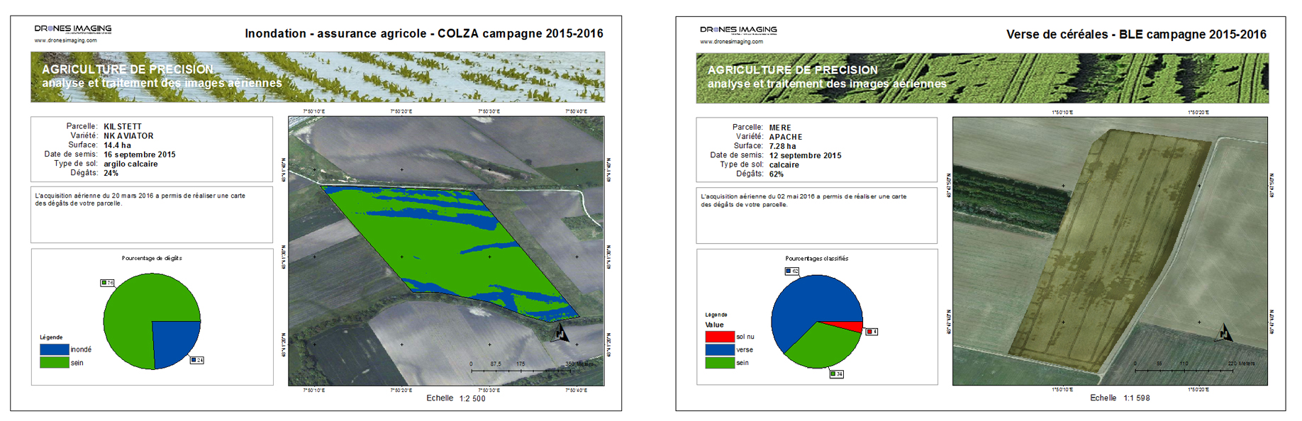
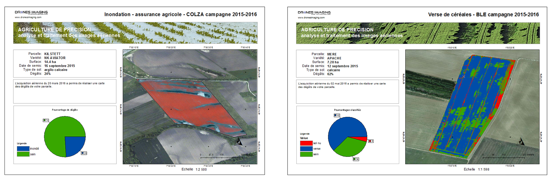
Weather damage: lodging, hail etc.
Flood damage.
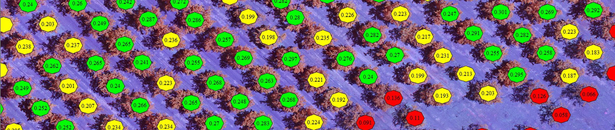
Counts.
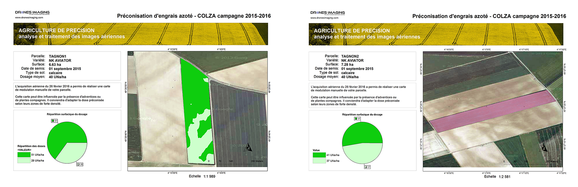
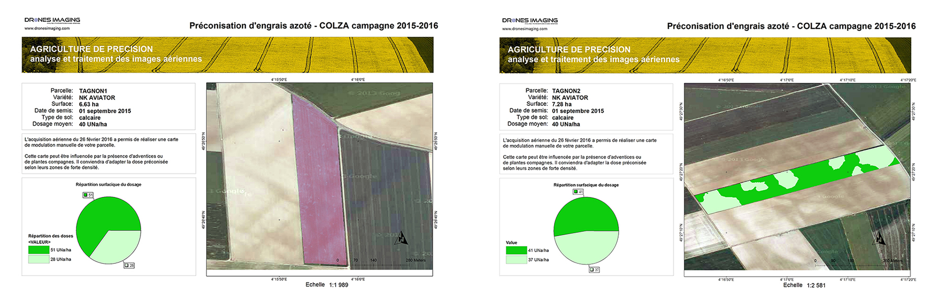
Modulation of nitrogen inputs.
Game damage
GeoTiff, Pdf formats
Weather damage
GeoTiff, Pdf formats
Flood damage
GeoTiff, Pdf formats
Automatic counting
Shp, Dwg, Dxf formats
Modulation of nitrogen inputs
GeoTiff, Pdf formats
Your turnkey deliverables
Your recommendation maps for modulating inputs
Nitrogen supply modulation maps for agricultural plots. Work achievable from your multispectral images dataset (all sensors) taken during stable solar illumination (preferably cloudy weather) and whose overlaps meet photogrammetry standards. Contact us for more information.
Your game damage maps
Realization of customizable maps, geolocated with statistical summary of damage (by class). Work achievable from your RGB image dataset whose overlaps meet photogrammetry standards (preferably dual flight grid). Contact us for more information.
Your farming damage maps
Realization of customizable maps, geolocated with statistical summary of damage (by class). Work achievable from your RGB image dataset whose overlaps meet photogrammetry standards (preferably dual flight grid). Contact us for more information.