Skip to content
Services et traitements des images aériennes
Twitter Facebook Linkedin
  • Français
  • English
DRONES IMAGING
  • Drones imaging
    • Who are we
  • images processing service
    • topographic service
    • thermographic service
    • agricultural service
    • automatic counting service
    • Use case
    • Product sheets
    • useful documentation
    • download guide
  • Trainings
    • training in photogrammetry metashape option
    • training in photogrammetry Pix4D option
    • Multispectral training
    • online photogrammetry training
  • Softwares
    • Agisoft Metashape photogrammetry software
    • Undet software
  • RTK Receivers
    • EMLID GNSS RTK Reach RS3
    • EMLID GNSS RTK Reach RS2+
    • Emlid GNSS RTK Reach RX
    • EMLID GNSS RTK Reach RS+
  • Sensors
    • Agrowing Multispectral cameras
  • News
  • Contact us
  • Toggle website search
Menu Close
  • Drones imaging
    • Who are we
  • images processing service
    • topographic service
    • thermographic service
    • agricultural service
    • automatic counting service
    • Use case
    • Product sheets
    • useful documentation
    • download guide
  • Trainings
    • training in photogrammetry metashape option
    • training in photogrammetry Pix4D option
    • Multispectral training
    • online photogrammetry training
  • Softwares
    • Agisoft Metashape photogrammetry software
    • Undet software
  • RTK Receivers
    • EMLID GNSS RTK Reach RS3
    • EMLID GNSS RTK Reach RS2+
    • Emlid GNSS RTK Reach RX
    • EMLID GNSS RTK Reach RS+
  • Sensors
    • Agrowing Multispectral cameras
  • News
  • Contact us
  • Toggle website search

thermographic service

  1. Home>
  2. thermographic service

Thermographic imageS processing service

From images and/or thermal infrared videos taken by drone or other, Drones Imaging provides its expertise with buildingf radiometric orthomosaics and textured 3D models. We thus provide you with precise and useful geospatial data for civil engineering, photovoltaic industry, ecology or agriculture sectors. Entrust us with your images and we will process them as soon as possible.

Thermographic processing

We build your geospatial data

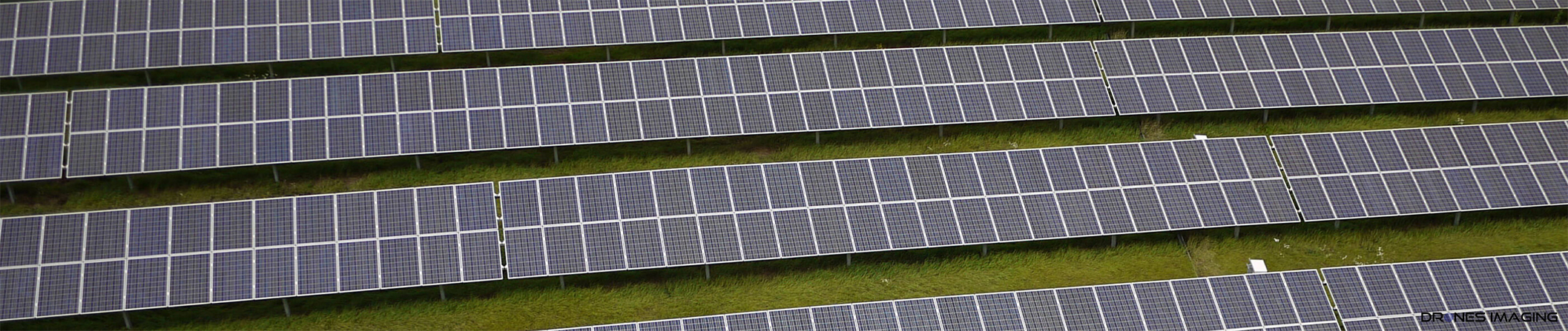
  • Radiometric orthophoto (GeoTIFF, KMZ, ECW, JPG2000 and other formats).
  • Non-radiometric orthophoto (GeoTIFF, KMZ, ECW, JPG2000 and other formats).
  • Digital Temperature Model (GeoTIFF or other formats).
  • Thermal 3D model (Obj and other formats).
  • RGB + thermal 3D model (Obj and other formats).
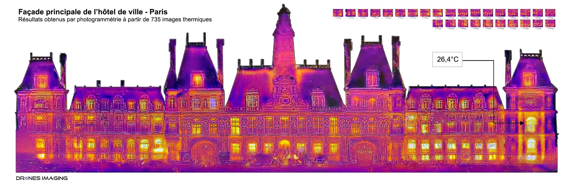
Thermal orthofacade
GeoTiff, Ecw, Jpg2000, Kmz formats
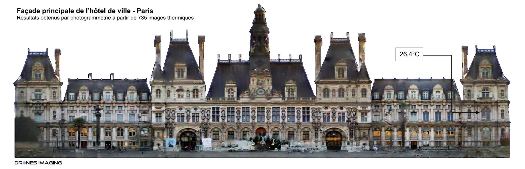
Radiométric orthophoto
GeoTiff, Ecw, Jpg2000, Kmz formats
Digital Temperature Model
GeoTiff format
Thermal 3D model
Obj, Tls or other formats
Hybrid RGB/Thermal 3D model
Obj, Tls or other formats

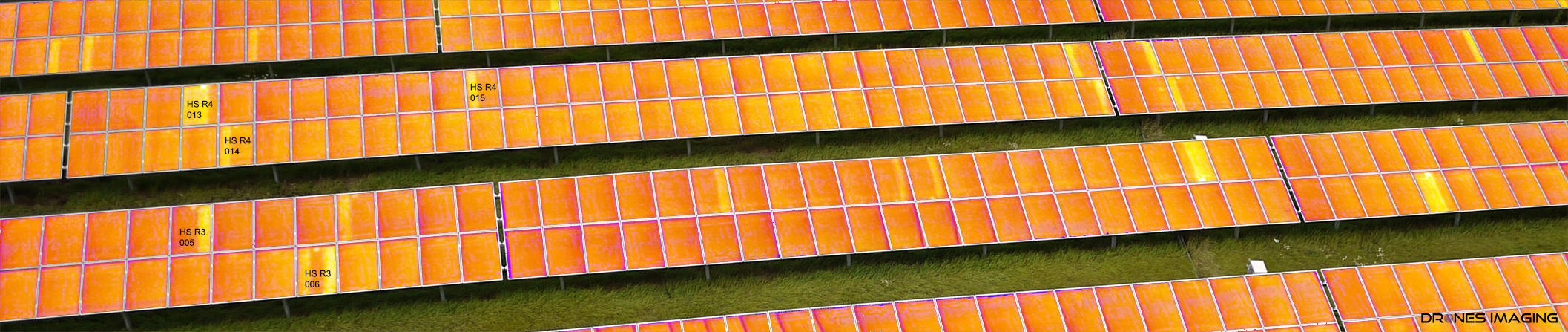
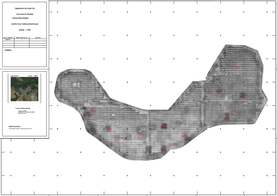
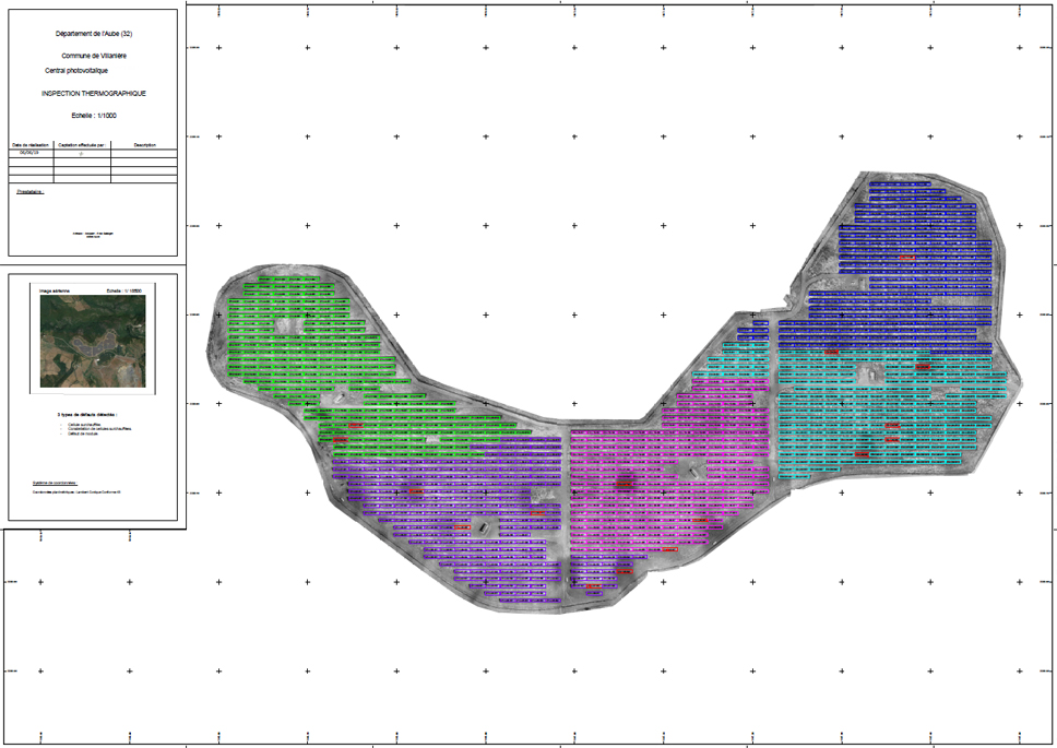
Thermographic analysis

We analyze your geospatial data

  • Photovoltaic plant inspection (DWG, PDF and other formats).
  • Heating network maps (DWG, PDF, SHP, KMZ formats).
  • Roof inspection reports (DWG, PDF formats).
  • Vegetation water stress (DWG, PDF or other formats).
  • Buried signatures for archaeology.
Detection map
Autocad compatible - Pdf and Dwg formats
Detection map
Pdf and Dwg formats with clickable layer
Nomenclature
Standardized denomination of each panel
Positive detection
Classification by type: hot spots, constellations, strings etc.
Reporting
Summary and performance statistics

Solar plant inspection - your turnkey deliverables

Anomaly plan by defect class

Thermographic service map

Anomaly map and panel nomenclature

thermographic service heat detection

RGB and thermal correlation

Superposition of visible and thermal layers for optimal analysis

RGB + thermal infrared textured models

Roof thermal inspection

Building thermal inspection

Our references

Dalkia
Bouygues
Engie
Stellantis
geodis
Edf
sdao
  • Mentions légales
  • Français
  • English