Aerial images processing and analysis services
Founded in 2013, Drones Imaging is a design office stemming from civil and military engineering. It synthesizes technical expertise in remote sensing, geomatics, analysis, photogrammetric processing and aerial image capture. With over 25 years experience in remote sensing, Drones Imaging will offer you professional quality services in the fields of geomatics, photogrammetry and professional training.
As part of a post-processing partnership, Drones Imaging will offer you professional quality of deliverables and continuous access to cutting-edge technology. For this, we have the best software suites selected according to your needs, for optimal rendering and quality
Our image processing services
All our work is delivered from the original images and at optimum resolution. If you find that the quality is not good enough, we will make it necessary corrections.
- NATO standardized ISR operating reports.
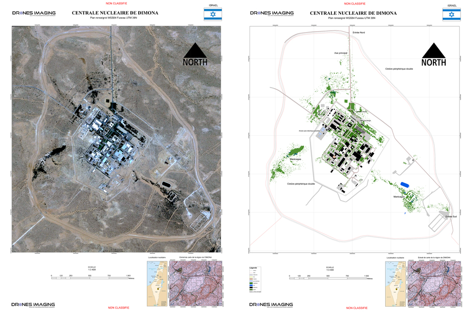
- NATO standardized 2D/3D maps.
- Terrain reconnaissance for military operations.
- Preparation of special operations and law enforcement.
- cylindrical orthophotos.
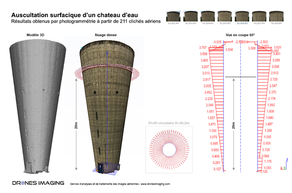
- Surface auscultation and disorders detections.
- Calculations of structural deformations.
- Building measurements.
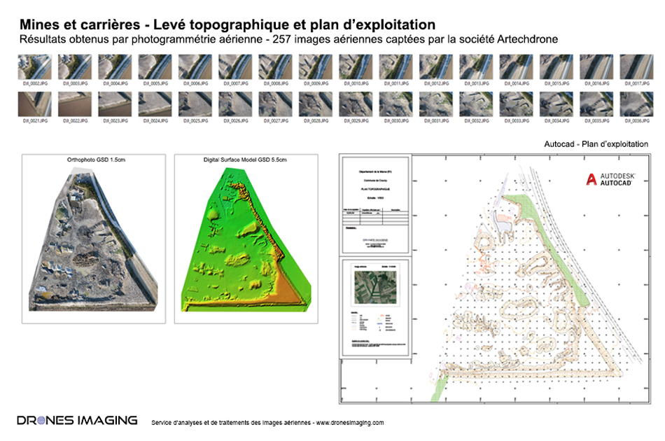
- Topographic surveys (point clouds and orthophotos).
- Stock volume reports formatted with your logo.
- Standardized Autocad topographic maps.
- Differential volumetry, profile books and others
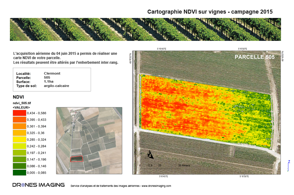
- NDVI / Biomass.
- Vegetated area classification and monitoring.
- Game and weather damages.
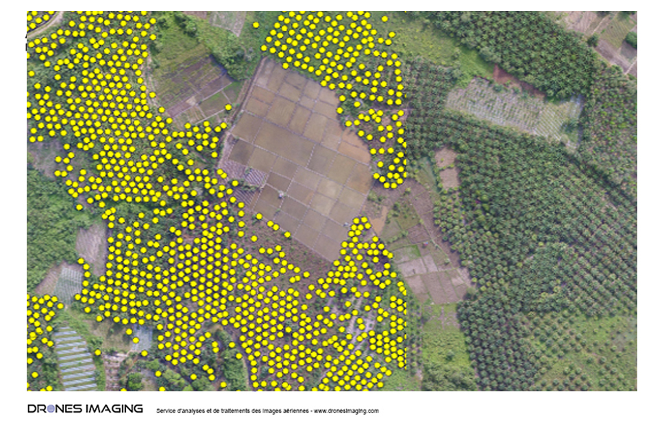
- Plantation counting.
- Raw or radiometric orthophotos.
- 3D models with thermal texture.
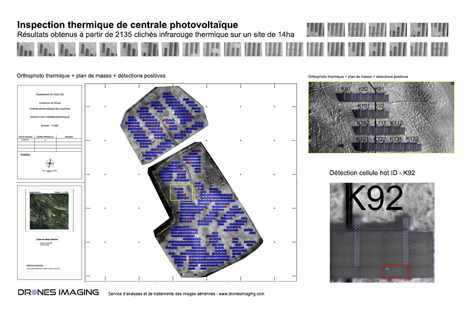
- Photovoltaic power plants inspections.
- Underground heating networks maps.
- Plantation counting.
- Vehicle counting.
- Missing plantations.
- Mono and multi supervised classification.
Our post-processing workflow
From take-off to post-processing, an aerial photography mission can be difficult to prepare. If you need help with flight planning, acquisition strategy, target setting, geo-tagging, post-production or setting up your photographic sensor: contact us, we can help you
Geospatial data production
- Downloading your image data sets + target coordinates by wetransfer or other means.
- Quality control of your images sent and photogrammetry software selection.
- Camera calibration and aerial triangulation.
- Georeferencing and spatial accuracy control.
- Artefacts and noise cleaning.
- Clean formatting.
- Datas delivery by wetransfer within 6/48 hours: points cloud, orthophotos, 3D models (all requested formats).
- After-sales service by email or immediate telephone contact.
Geospatial data analysis
- Downloading your orthophotos, point clouds or DEMs by wetransfer or other means.
- Quality control of your datas sent.
- Running automatic classification and deep learning tools.
- Building of drawing layers by codified class.
- Merging vector layers with Autocad or other.
- Quality control of your deliverable (topographic map, volumetry, inspection).
- Formatting and uncluttered presentation of your deliverable with your logos.
- Delivery of your productions ordered by wetransfer.
- After-sales service by email or immediate telephone contact.
State-of-the-art software at your service
To guarantee you an irreproachable quality of deliverables, we select our best softwares according to the specificity of your request, the expected rendering and technical characteristics of your sensor.
