Skip to content
Services et traitements des images aériennes
Twitter Facebook Linkedin
  • Français
  • English
DRONES IMAGING
  • Drones imaging
    • Who are we
  • images processing service
    • topographic service
    • thermographic service
    • agricultural service
    • automatic counting service
    • Use case
    • Product sheets
    • useful documentation
    • download guide
  • Trainings
    • training in photogrammetry metashape option
    • training in photogrammetry Pix4D option
    • Multispectral training
    • online photogrammetry training
  • Softwares
    • Agisoft Metashape photogrammetry software
    • Undet software
  • RTK Receivers
    • EMLID GNSS RTK Reach RS3
    • EMLID GNSS RTK Reach RS2+
    • Emlid GNSS RTK Reach RX
    • EMLID GNSS RTK Reach RS+
  • Sensors
    • Agrowing Multispectral cameras
  • News
  • Contact us
  • Toggle website search
Menu Close
  • Drones imaging
    • Who are we
  • images processing service
    • topographic service
    • thermographic service
    • agricultural service
    • automatic counting service
    • Use case
    • Product sheets
    • useful documentation
    • download guide
  • Trainings
    • training in photogrammetry metashape option
    • training in photogrammetry Pix4D option
    • Multispectral training
    • online photogrammetry training
  • Softwares
    • Agisoft Metashape photogrammetry software
    • Undet software
  • RTK Receivers
    • EMLID GNSS RTK Reach RS3
    • EMLID GNSS RTK Reach RS2+
    • Emlid GNSS RTK Reach RX
    • EMLID GNSS RTK Reach RS+
  • Sensors
    • Agrowing Multispectral cameras
  • News
  • Contact us
  • Toggle website search

Blog

  1. Home>
  2. geomatics>
  3. Roof inspection by drone and photogrammetry

Roof inspection by drone and photogrammetry

  • February 26, 2018
  • 1:30 pm

Roof inspection by drone.

Roof inspection by drone: detection and localization of sealing plate peeling off. Results obtained from 235 aerial shots taken by the company Artech’Drone. Image post-processing and analysis service by Drones Imaging.

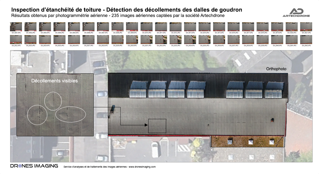
Orthophoto and damage visual restitution

Roof inspection by drone

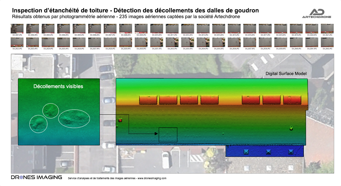
3D modeling and damage restitution

Roof inspection

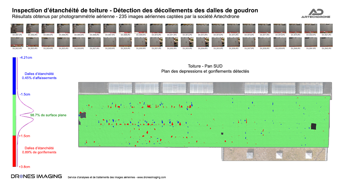
Automatic detection and localization of disorders

Roof inspection

Analysis carried out as part of an inspection aimed at detecting and locating the tar slabs detachments onto south side of the roof (with a minimum tolerance of 1.5cm).

With this commercial use case and thanks to the Metashape software, the analysis of the digital surface model made it possible to quantify and locate all the waterproofing defects onto the roof (holes and bumps whose amplitude is between 1.5 and 4cm). Apart from these detected defects, our results revealed that 98.7% of the sealing layer was flat (compliant, without pathology).

TECHNICAL INFORMATIONS

  • Aerial imagery processing service : Drones Imaging company.
  • Flights and aerial imagery : Artech’Drone company.
  • Spatial accuracy : centimeter.
  • Orthophoto RVB : GSD 1mm.
  • Drone : DJI Inspire 2.
  • Sensor :  FC6520.
  • Covered area : 700m².
  • Photogrammetry software : Metashape.
  • Export formats : GéoTiff, Shp et Pdf.
  • Delivery delay : 2 days upon images dataset receipt.
PrevPrécédentFlood forecasting: Topographic survey in Niamey to deal with the rise of the Niger River
SuivantTopographic survey and annual mining mapNext
  • Mentions légales
  • Français
  • English