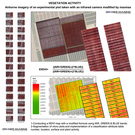
NDVI Vegetation Index
NDVI Vegetation Index: aerial images collection made on an experimental agricultural plot with a drone and infrared sensor. Realization of a NDVI map with a modified formula using NIR, GREEN & BLUE channels. Subsequent segmentation and classification of micro plots with implementation of attribute values such as: plot number, geographical location, surface area and plant vigor according to the calculated NDVI index.
Near infrared orthophoto and NDVI
TECHNICAL INFORMATIONS
- Multispectral image processing service : Drones Imaging company.
- Flights and aerial imagery : Azur drones company.
- Spatial accuracy : metric with BD Ortho l’IGN and centimeter in relative.
- Total analyzed area : 08ha.
- Drone : Multirotor Hexacopter.
- Multispectral sensor : CANON SX260HS MaxMax.
- Photogrammetry software : Agisoft Metashape.
- Geographic Information System : Arcgis.
- Export formats : GeoTiff, Shp, Xls and Kmz.
- Completion deadlines : 2 days.