Skip to content
Services et traitements des images aériennes
Twitter Facebook Linkedin
  • Français
  • English
DRONES IMAGING
  • Drones imaging
    • Who are we
  • images processing service
    • topographic service
    • thermographic service
    • agricultural service
    • automatic counting service
    • Use case
    • Product sheets
    • useful documentation
    • download guide
  • Trainings
    • training in photogrammetry metashape option
    • training in photogrammetry Pix4D option
    • Multispectral training
    • online photogrammetry training
  • Softwares
    • Agisoft Metashape photogrammetry software
    • Undet software
  • RTK Receivers
    • EMLID GNSS RTK Reach RS3
    • EMLID GNSS RTK Reach RS2+
    • Emlid GNSS RTK Reach RX
    • EMLID GNSS RTK Reach RS+
  • Sensors
    • Agrowing Multispectral cameras
  • News
  • Contact us
  • Toggle website search
Menu Close
  • Drones imaging
    • Who are we
  • images processing service
    • topographic service
    • thermographic service
    • agricultural service
    • automatic counting service
    • Use case
    • Product sheets
    • useful documentation
    • download guide
  • Trainings
    • training in photogrammetry metashape option
    • training in photogrammetry Pix4D option
    • Multispectral training
    • online photogrammetry training
  • Softwares
    • Agisoft Metashape photogrammetry software
    • Undet software
  • RTK Receivers
    • EMLID GNSS RTK Reach RS3
    • EMLID GNSS RTK Reach RS2+
    • Emlid GNSS RTK Reach RX
    • EMLID GNSS RTK Reach RS+
  • Sensors
    • Agrowing Multispectral cameras
  • News
  • Contact us
  • Toggle website search

Blog

  1. Home>
  2. geomatics>
  3. Historical orthophoto of the Dunkirk city in 1949

Historical orthophoto of the Dunkirk city in 1949

  • October 8, 2019
  • 12:51 pm

Historical orthophoto of the Dunkirk city in 1949

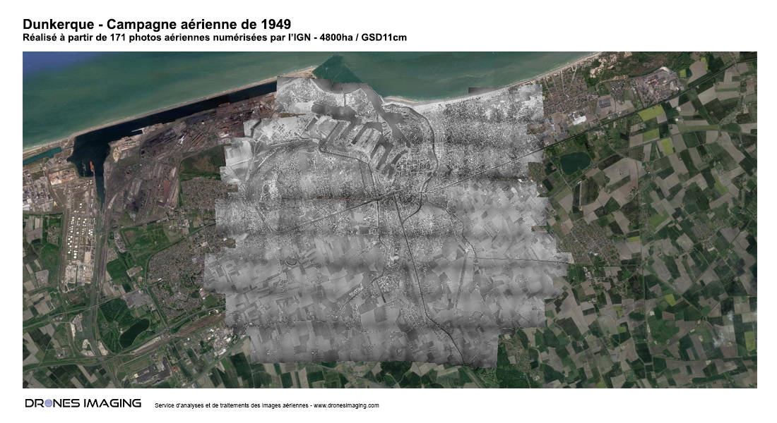
Historical orthophoto of Dunkirk built for the observation of the territory over time. Results obtained from 171 scanned silver images available with the IGN webportal.

Visualization of the full resolution orthophoto GSD 11cm

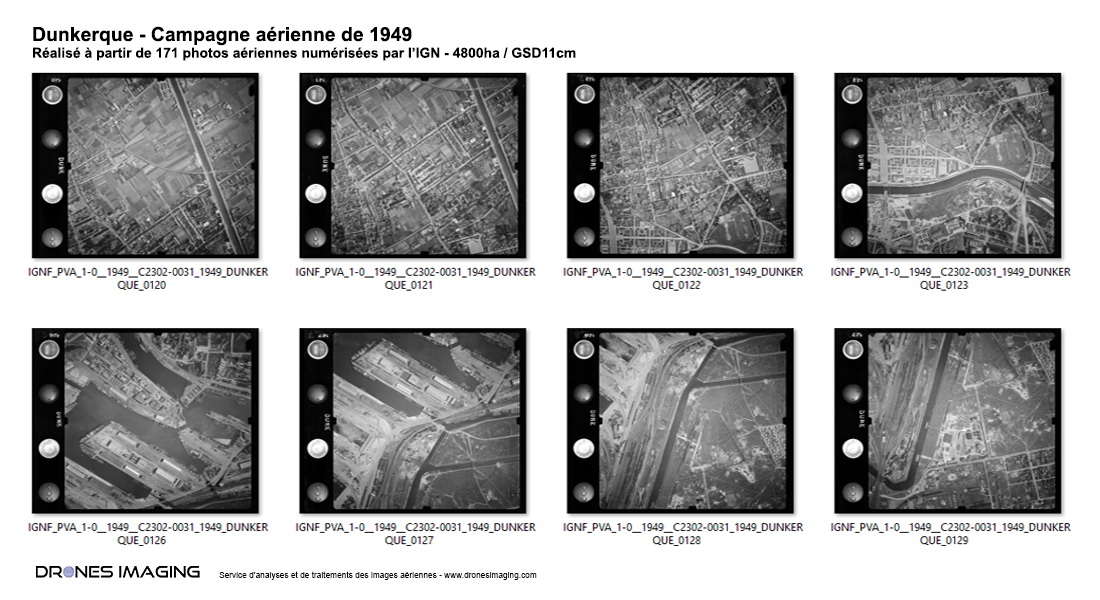
Silver images of the Dunkirk city in 1949

Siver images of Dunkirk in 1949

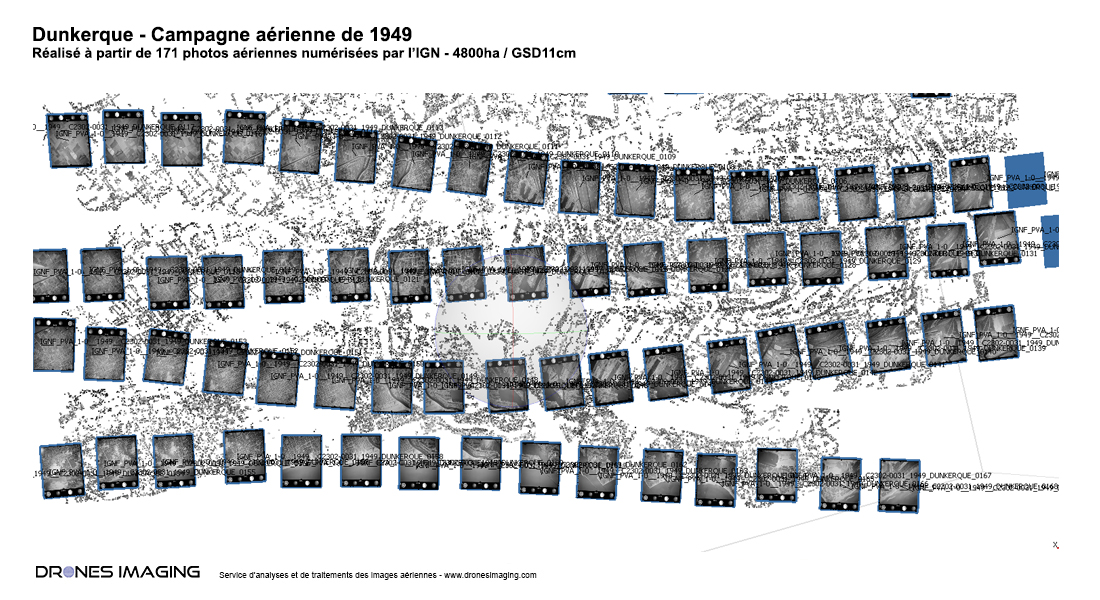
Silver images alignement step with Agisoft Metashape software

Metashape silver images alignment step

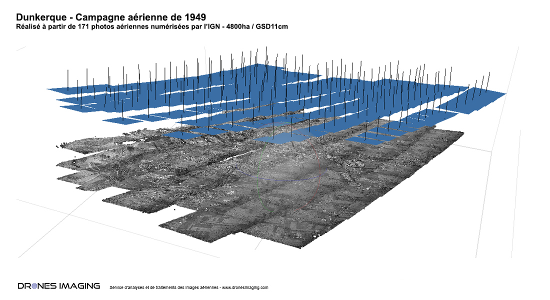
Densification and 3D meshing step

3D modeling of the Dunkirk city

Visualization of the orthophoto with Google Earth

Historical orthophoto of Dunkirk

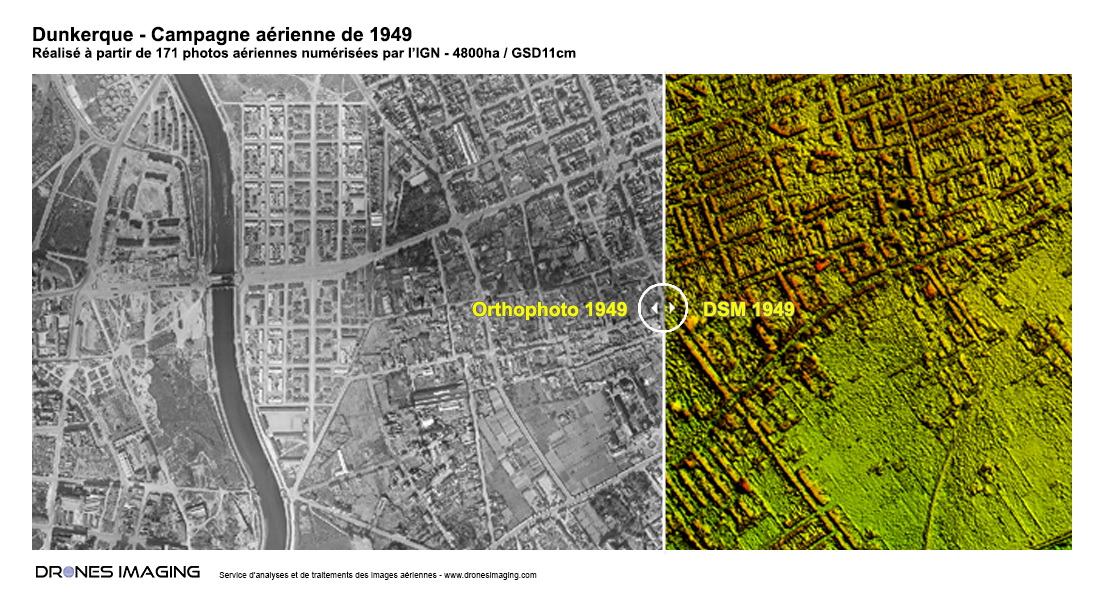
Orthophoto and Digital Surface Model of the Dunkirk city

Historical orthophoto and DSM of Dunkirk

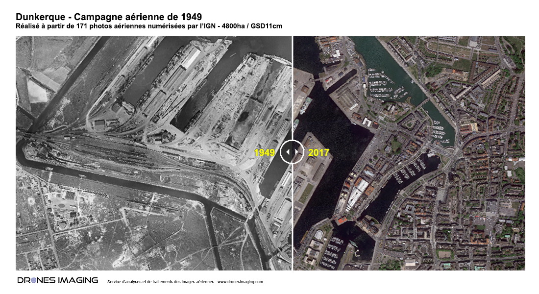
Port of Dunkirk - Before 1949 / After 2017

Historical orthophoto of Dunkirk

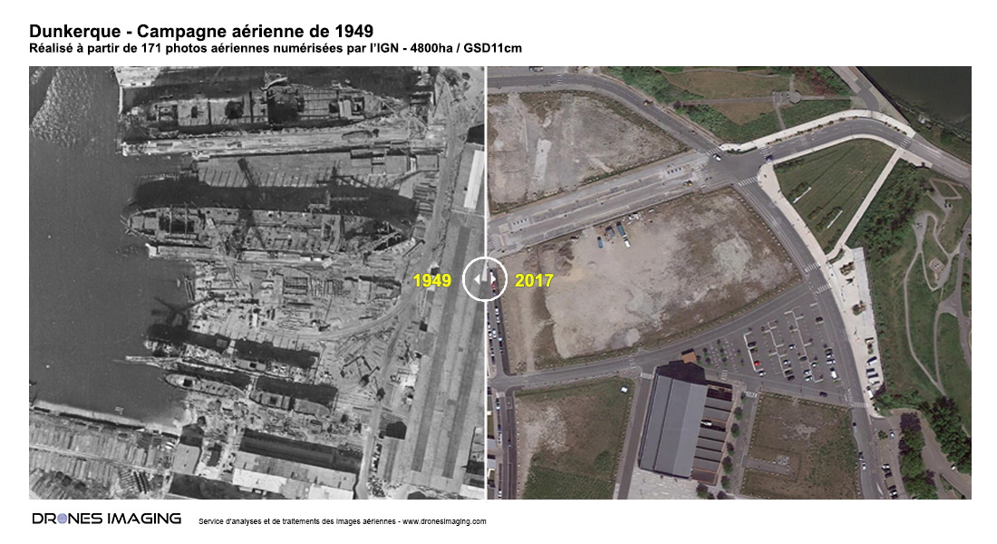
Dunkirk port repair workshop - Before 1949 / After 2017

Historical orthophoto of Dunkirk

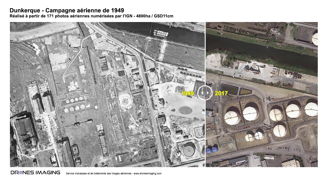
Hydrocarbon storage area - Before 1949 / After 2017

before after dunkirk

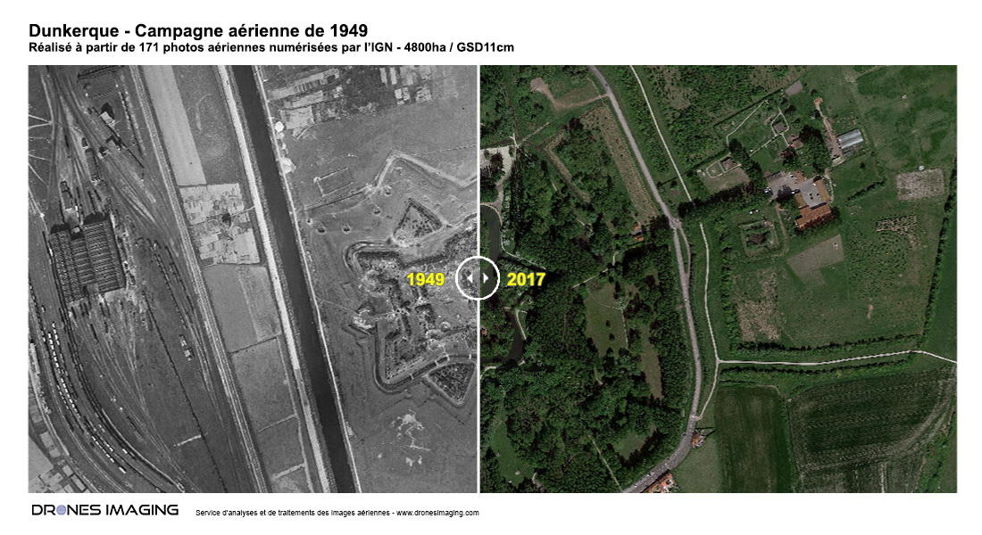
Vauban Citadel of Dunkirk - Before 1949 / After 2017

before after dunkirk

TECHNICAL INFORMATIONS

  • Data processing service : Drones Imaging company
  • Aerial images source : IGN
  • Spatial accuracy : metric
  • Orthophoto RVB : GSD 11cm
  • Total built area : 4900ha
  • Aerial airborne platform : plane
  • Sensor : unknown
  • Photogrammetry software : Agisoft Metashape
PrevPrécédentFacade inspection by drone and aerial photogrammetry
SuivantLe Castellet – Survey and topographic map of the Paul Ricard racing circuit made by drone and aerial photogrammetryNext
  • Mentions légales
  • Français
  • English