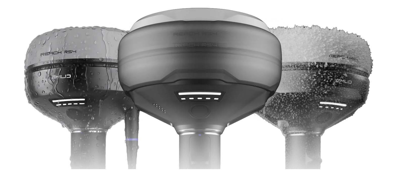
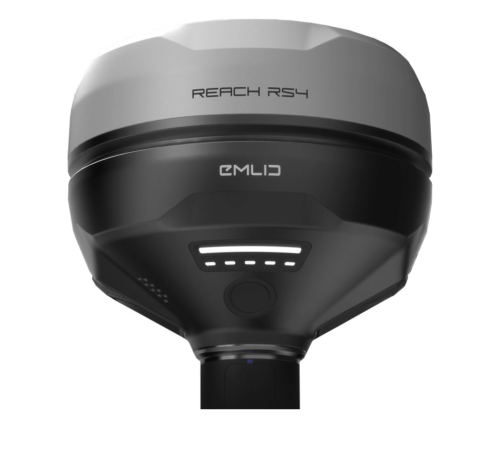
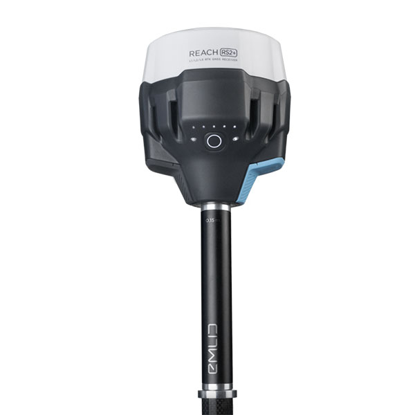
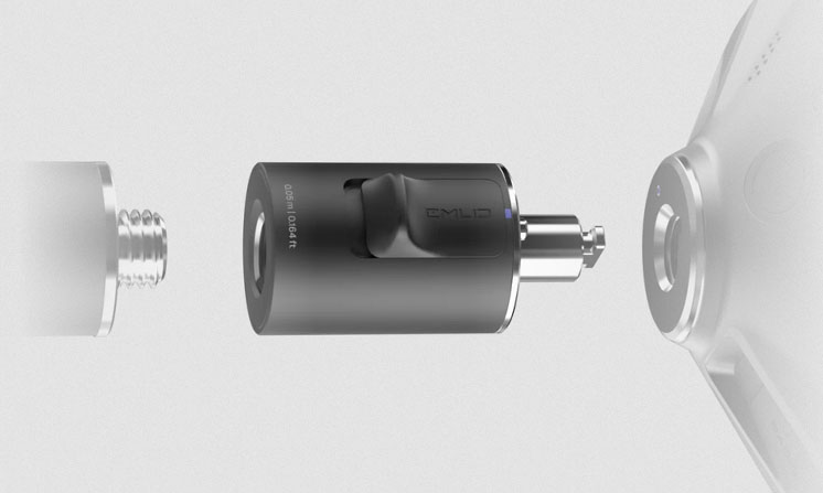
Emlid RS4, the new benchmark in all-band GNSS RTK precision for reliable measurements
Equipped with all-band GNSS RTK technology, the brand-new Emlid RS4 receiver delivers exceptional precision, even in the most demanding environments. Designed to withstand the harshest conditions while providing top-tier performance, it ensures reliable and consistent positioning—whether in urban areas or under dense vegetation. Compact, fast, and intuitive, the RS4 stands out as the ideal tool for professionals seeking ultimate precision in the field.
Next-generation tilt compensation for optimal accuracy in the field
The Emlid Reach RS4 delivers consistent centimeter-level accuracy, even when the receiver is tilted at steep angles. For example, at a 30° tilt, it maintains an 18 mm accuracy in RTK mode, thanks to its next-generation advanced tilt compensation system. This mechanism activates in just seconds, after only a few movements, ensuring optimal stability throughout surveying operations. This technology not only saves valuable time in the field but also eliminates interruptions caused by recalibration, even in the most challenging environments—such as dense wooded areas or urban canyons.
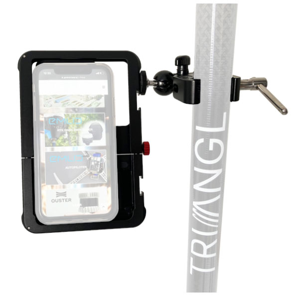
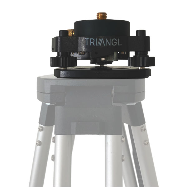
Quick Release Tilt Compensation Mount – Performance and Precision
This mount is specifically designed to provide precise and stable tilt compensation, eliminating any mechanical play and ensuring a secure attachment of the receiver to the survey pole. Even the slightest movement between the device and the pole can compromise measurement accuracy during tilted operations. Thanks to its thoughtful design and quick-release system, the mount guarantees an instant, robust, and reliable connection. This allows professionals to achieve maximum precision and increased productivity, regardless of the complexity of field conditions.
Reliable location technologies under vegetation cover or in dense areas
The Emlid Reach RS4 delivers centimeter-level accuracy, even in the most challenging environments, such as dense forests or urban canyons. By leveraging all GNSS constellations (GPS, GLONASS, Galileo, BeiDou, etc.) and their multiple frequencies—including the L5 and L6 bands—it minimizes disruptions caused by multipath interference.
With 672 channels, the RS4 can track over 40 satellites simultaneously, ensuring rapid signal acquisition and optimal positioning stability, even in the toughest conditions.
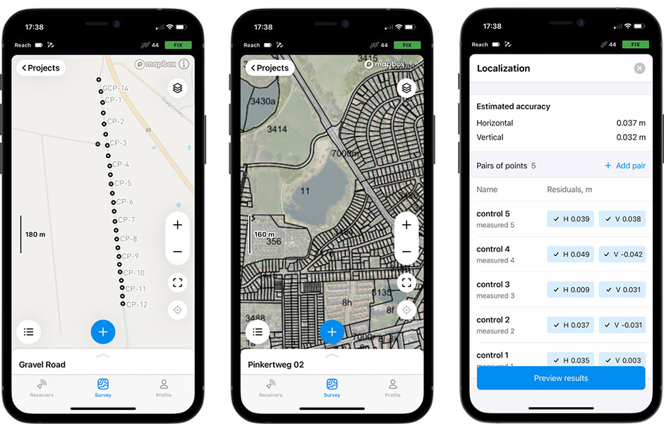
With Point Collection, create custom projects by recording your points with personalized attributes and descriptions tailored to each situation. You can also define specific rules, such as the minimum logging duration or other project-specific parameters.
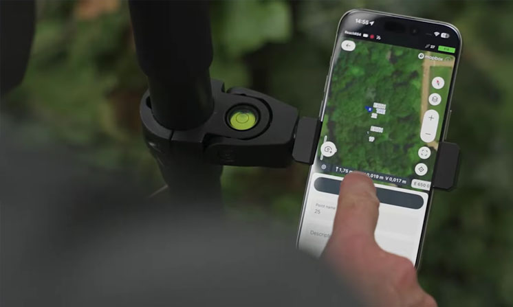
Data capture is fast and intuitive, thanks to the clear and user-friendly interface of the Emlid Flow app, designed in a style similar to popular mapping applications.
During navigation, Emlid Flow guides you in real time toward your recorded points. When you are within 50 cm of the target point, the app automatically switches to target view: simply adjust the receiver’s position following the on-screen indicators until the display turns green, confirming that you are perfectly aligned.
Finally, for logging, GNSS data can be recorded in real time, with support for NMEA or RINEX formats, allowing post-processing if needed and ensuring maximum flexibility for your future analyses.