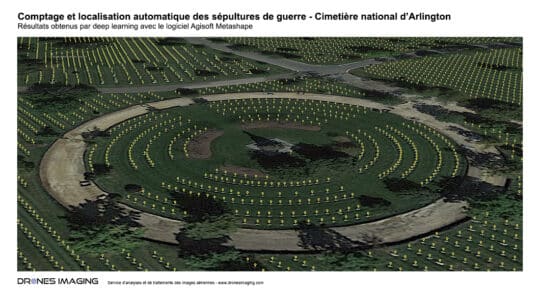
Automated Mapping of War Graves – Arlington National... Non classé January 17, 2024 Automatic Detection and Localization of Graves in a Military Cemetery using Agisoft Metashape Software Automatic tomb counting at Arlington Continuer la lecture
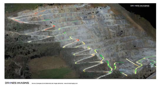
Mining industry: motorable tracks study for the benefit... Non classé May 4, 2017 Slopes classification of the motorable tracks for mining industry Slopes classification: results obtained from 640 aerial images taken by Continuer la lecture
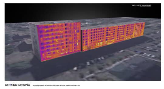
3D thermal mapping by photogrammetry Non classé April 8, 2017 Thermal 3d modeling carried out by terrestrial photogrammetry Thermal 3D modeling of a building: result obtained by photogrammetry on Continuer la lecture
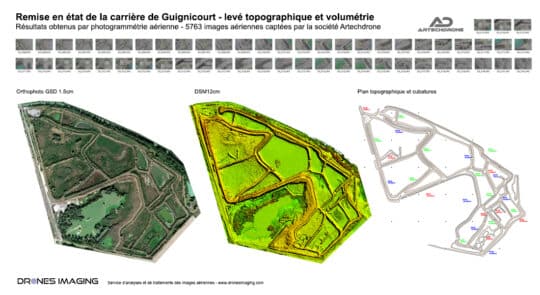
Volume calculation of cuttings and embankments for a... Non classé March 27, 2017 Cut and fill calculations for an extraction site rehabilitation Cut and fill calculations for depollution and restoration of the Continuer la lecture
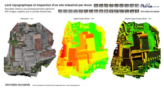
Topographic survey and roofs inspection Non classé December 2, 2016 Topographic survey of an industrial site Topographic survey and roofs inspection of an industrial site. Results obtained from 495 Continuer la lecture