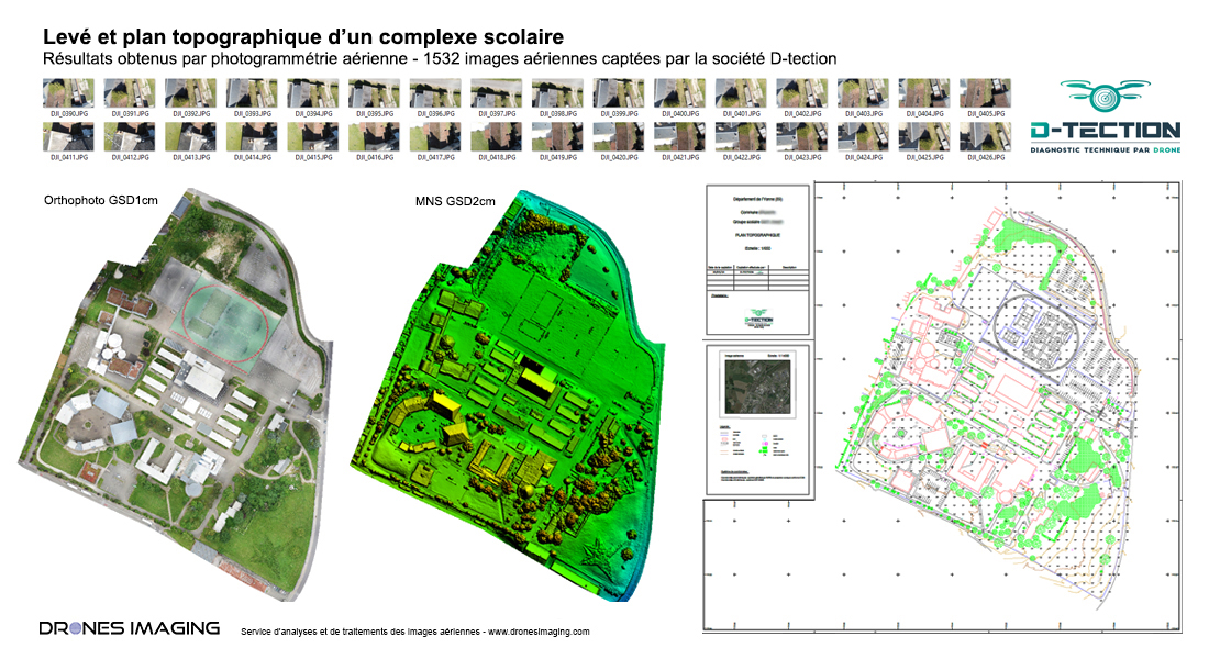
Autocad map of a school complex built by drone and aerial photogrammetry
Autocad map of a 10ha area built from orthophoto and classified Digital Surface Model.
Autocad map, July 2019 – Results obtained from 1532 aerial images taken by D-Tection, a company specializing in aerial surveys and industrial inspections.Post-processing and geomatics by Drones Imaging.
Orthophoto, Digital Surface Model and autocad map
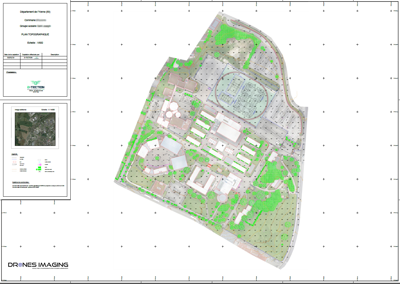
Layered Autocad map and orthophoto
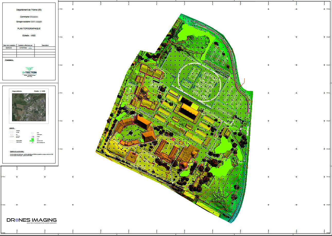
Autocad plan and Digital Surface Model
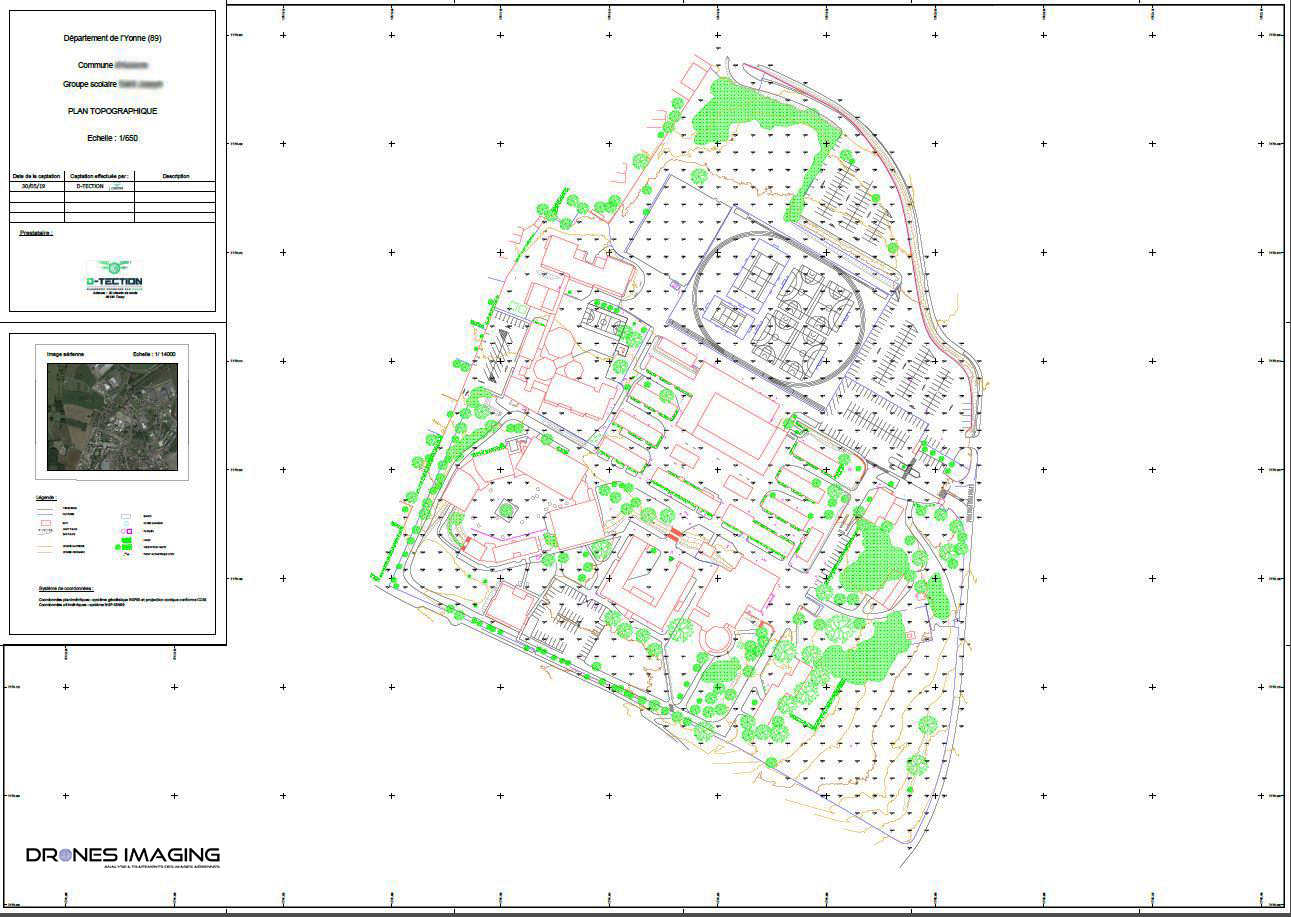
Autocad plan in Dwg format
School site map delivered in Pdf and Dwg formats for the benefit of an architectural firm. Service performed for the updating of the site and the study of future extension works of the South-East grassed area.
Also and in the context of institutions at risk welcoming the public (about 1500 people), this topographic map and 3D model will serve as a support for the civil security and their intervention plans.
TECHNICAL INFORMATIONS
Aerial images processing service : Drones Imaging design office