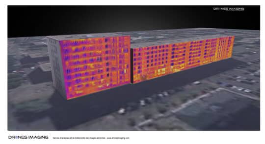
Modélisation 3D thermique réalisée par photogrammétrie terrestre Modélisation 3D thermique d’une façade d’immeuble: résultat obtenu par photogrammétrie sur un
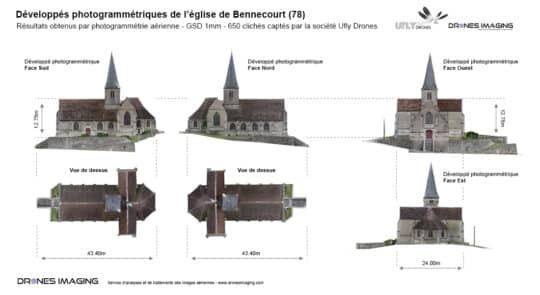
Photogrammétrie terrestre appliquée au BIM Photogrammétrie terrestre et jumeau numérique de l’église de Bennecourt. Levé topographique, octobre 2016: résultats