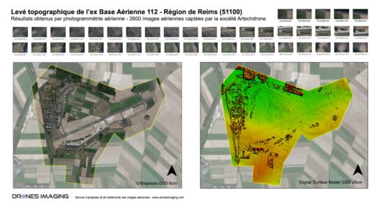
Photogrammétrie par autogire – Levé topographique de l’ex... Réalisations mars 19, 2019 Levé topographique de 1100 hectares réalisé par photogrammétrie aérienne Photogrammétrie aérienne par autogire, résultats obtenus à partir de 2600 Continuer la lecture