Inspection thermique d'une centrale photovoltaïque réalisée par drone et photogrammétrie aérienne
Inspection de panneaux photovoltaïques: résultats obtenus à partir de 2135 clichés aériens captés par la société Tech Drone Service.
Plan Autocad de 14ha réalisé à partir de l’orthophoto thermique.
Inspection de panneaux photovoltaïques: plan de défectuosités sur fond d'orthophoto thermique
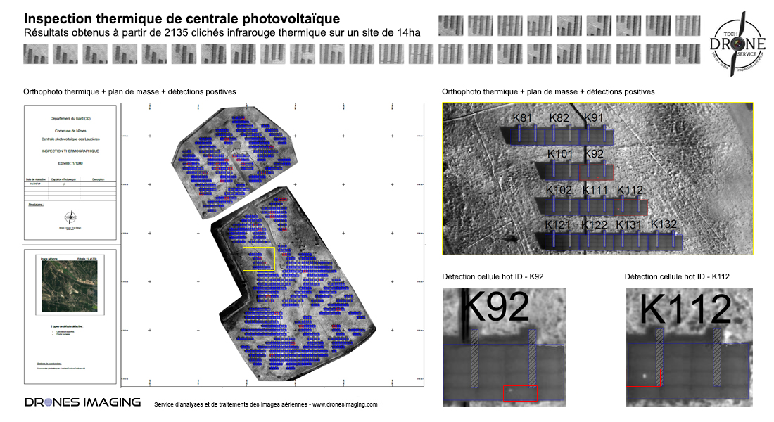
Ci-dessus et dans sa version finale, le plan Autocad sur lequel figurent les 720 panneaux inspectés (de couleur bleue). En rouge, 4 défauts « diode by pass » et 33 cellules surchauffées (hot spots) ont été identifiés grâce à leur température excessive enregistrée par la caméra thermique.
Plan clé en main directement livré au chargé d’études et construction avant la mise en service du site.
INFORMATIONS TECHNIQUES
- Service de traitement d’images : société Drones Imaging.
- Captation aérienne : Société Tech Drone Service.
- Précision spatiale : centimétrique en relatif.
- Orthophoto thermique : GSD 3cm.
- Surface totale inspectée : 14ha.
- Drone : DJI P4P.
- Caméra : FLIR XT2.
- Logiciel de photogrammétrie : Metashape.
- Prestation enseignée en formation : voir plus.