Inspection thermographique d'une centrale solaire par drone
Inspection d’une centrale solaire par drone et résultats obtenus à partir de 4352 clichés aériens captés par la société Tech Drone Service.
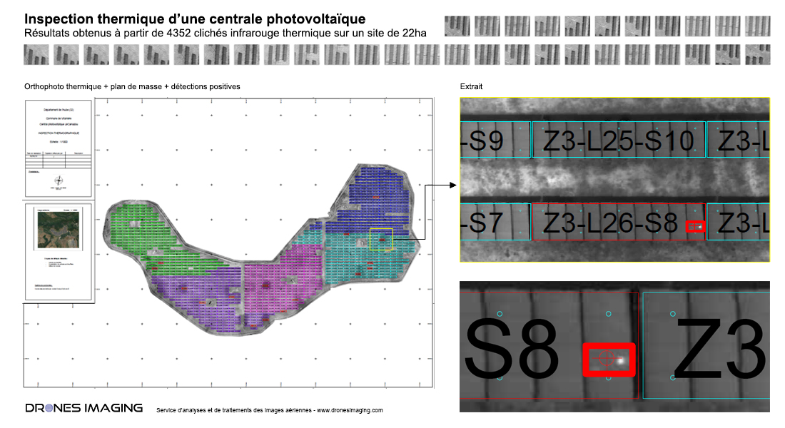
Plan Autocad réalisé à partir de l’orthophoto thermique sur une surface totale de 22ha.
Plan de défectuosités sur fond d'orthophoto thermique
Ci-dessus, le plan finalisé au format Autocad sur lequel figurent les 12130 panneaux inspectés. En rouge, les défauts détectés et classés par catégorie sous forme de calques « cellule surchauffée », « constellation de cellules surchauffées » et « défaut de module ».
Plan clé en main directement livré au chargé d’études et de construction pour la mise en service du site.
INFORMATIONS TECHNIQUES
- Service de traitement d’images : société Drones Imaging.
- Captation aérienne : Société Tech Drone Service.
- Précision spatiale : centimétrique en relatif.
- Orthophoto thermique : GSD 3cm.
- Surface totale inspectée : 22ha.
- Drone : DJI P4P.
- Logiciel de photogrammétrie : Metashape
- Prestation enseignée en formation : voir plus.