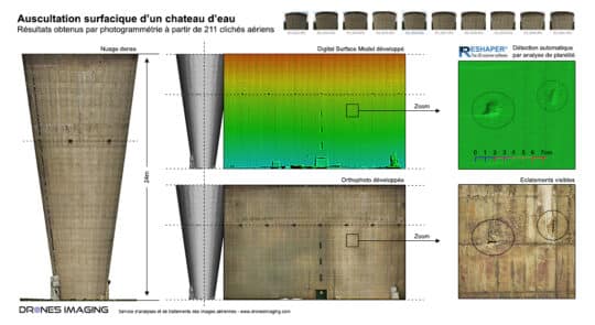
Auscultation des parois d’un château d’eau et détection... Réalisations avril 17, 2018 Inspection BIM par drone: analyse de surface et détection automatique de désordres Inspection BIM par drone: résultats obtenus à Continuer la lecture
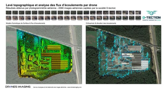
Risques technologiques – analyse des flux d’écoulements et... Réalisations mars 14, 2018 Étude de risques par drone – analyse des flux d’écoulements et simulation de la dispersion de polluants Étude de Continuer la lecture
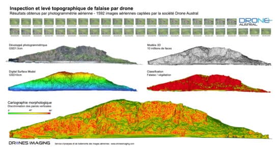
Levé 3D de la falaise du Cap Champagne... Réalisations mars 6, 2018 Suivi de falaise du Cap Champagne réalisé par drone et photogrammétrie – Île de la Réunion Suivi de falaise Continuer la lecture