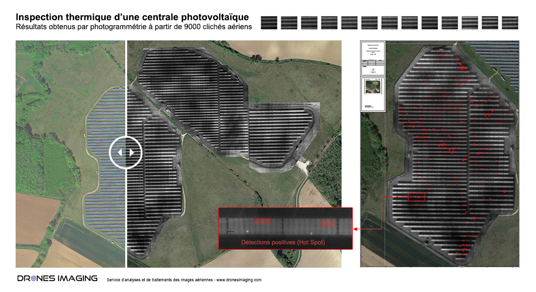
Inspection thermique de panneaux photovoltaïques - Détection et localisation des cellules surchauffées pour l'évaluation des pertes de rendement.
Inspection thermique: résultats obtenus à partir de 9000 thermogrammes captés par la société Tech Drone Service. Post-traitement et analyse par Drones Imaging.
Orthophoto infrarouge thermique réalisée dans le cadre d’une inspection visant à détecter et localiser les cellules défectueuses qui affectent le rendement de la centrale.
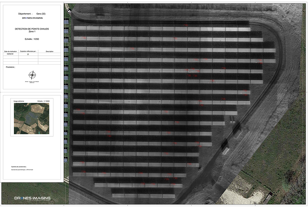
Orthophoto thermique et plan de détection des cellules surchauffées
Extrait du plan Autocad
Ci-dessous un extrait du livrable (zone Est) sous forme de plan standardisé Autocad avec étiquetage des cellules défectueuses, nomenclature du panneau et géoréférencement X-Y-Z (précision spatiale décimétrique).
INFORMATIONS TECHNIQUES
- Service de traitement d’images thermiques : société Drones Imaging.
- Captation aérienne : société Tech Drone Service.
- Précision spatiale : décimétrique.
- Orthophoto thermique : GSD 6cm.
- Surface totale inspectée : 19ha.
- Vecteur aérien : Drone DJI.
- Senseur IR Thermique : Zenmuse XTR.
- Logiciel de photogrammétrie : Metashape.
- Formats d’export : GéoTiff et Dwg autocad.
- Délais de livraison : 3 jours.
- Cas d’usage enseigné en formation : voir plus.