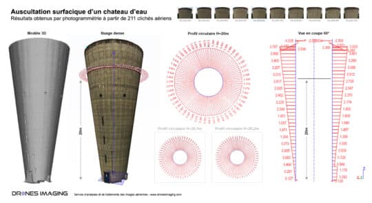
Inspection d’ouvrage d’art par drone – étude de... Réalisations août 10, 2018 Inspection d’ouvrage d’art par drone et étude de circularité d’un château d’eau par photogrammétrie aérienne. Inspection d’ouvrage d’art par Continuer la lecture
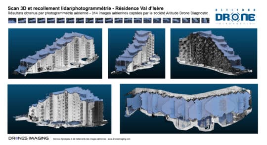
Modélisation 3D d’une résidence de tourisme par couplage... Réalisations novembre 15, 2017 Fusion laser et photogrammétrie: modélisation 3D d’une résidence de tourisme par couplage de données aériennes et terrestres Fusion laser Continuer la lecture