Réalisation d’une orthophoto de la ville de Dunkerque à partir d’anciennes images argentiques captées en 1949.
Orthophoto historique de la ville de Dunkerque en 1949
Création d’une orthophoto historique de Dunkerque pour l’observation du territoire au cours du temps. Résultats obtenus à partir de 171 clichés argentiques scannés disponibles sur le portail de l’IGN.
Visualisation de l'orthophoto en pleine résolution - GSD 11cm
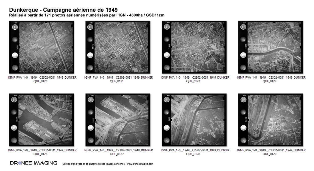
Images argentiques de la ville de Dunkerque en 1949
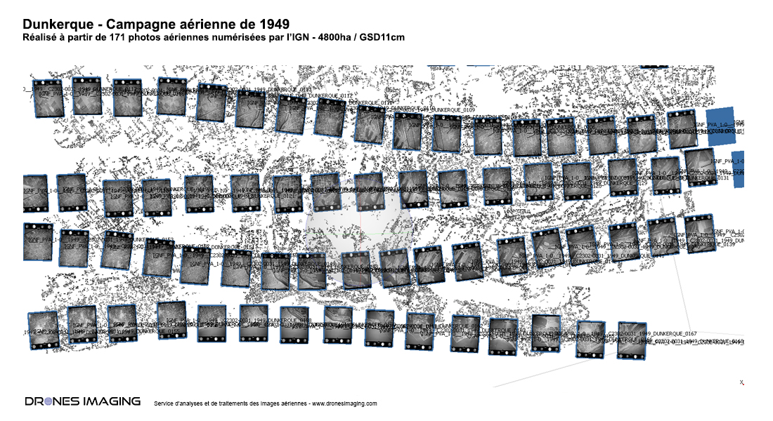
Alignement des images argentiques de Dunkerque avec le logiciel Agisoft Metashape
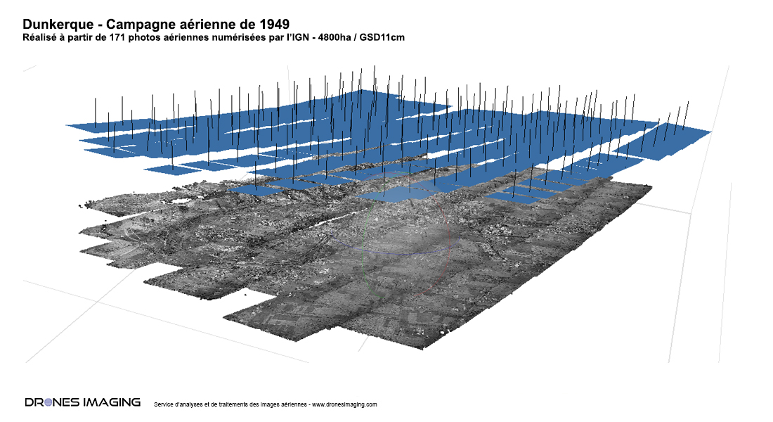
Densification et maillage 3D de la ville de Dunkerque
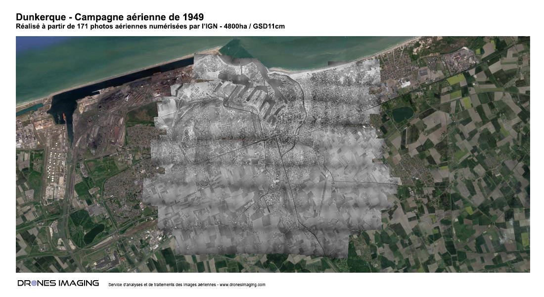
Orthophoto de Dunkerque en 1949 sur Google Earth
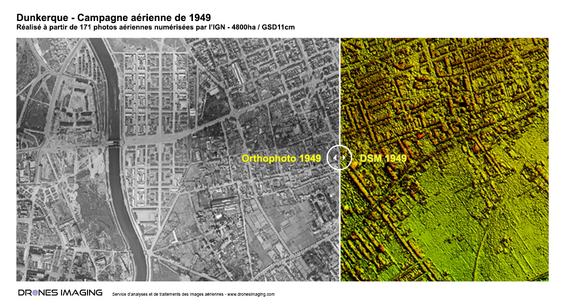
Orthophoto et Modèle Numérique de Surface de la ville de Dunkerque
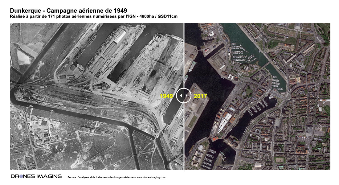
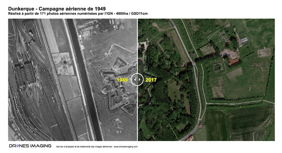
Port de Dunkerque - Avant 1949 / Après 2017
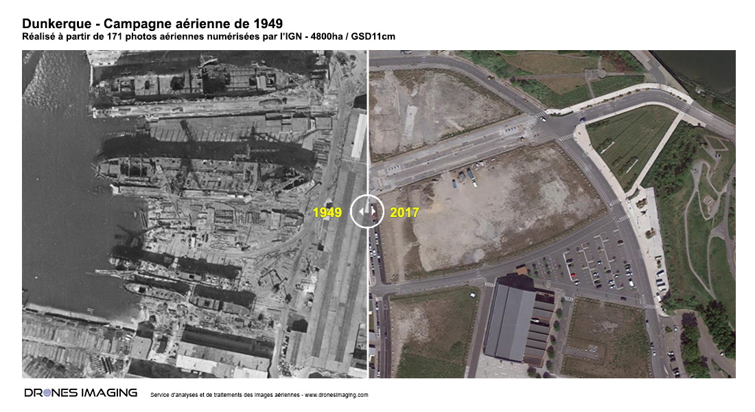
Atelier de réparation du port de Dunkerque - Avant 1949 / Après 2017
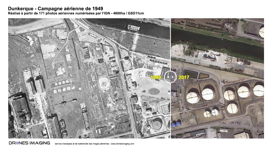
Zone de stockage d'hydrocarbures - Avant 1949 / Après 2017
Citadelle Vauban de Dunkerque - Avant 1949 / Après 2017