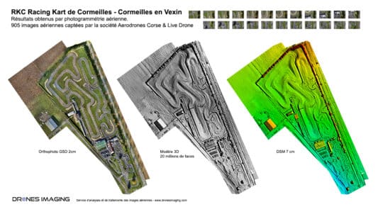
Mapping et levé topographique par drone – circuit... Réalisations février 17, 2017 Analyse topographique des pistes du circuit de karting RKC Analyse topographique et plan Autocad réalisés à partir du MNS Continuer la lecture