Comptage automatique par machine learning
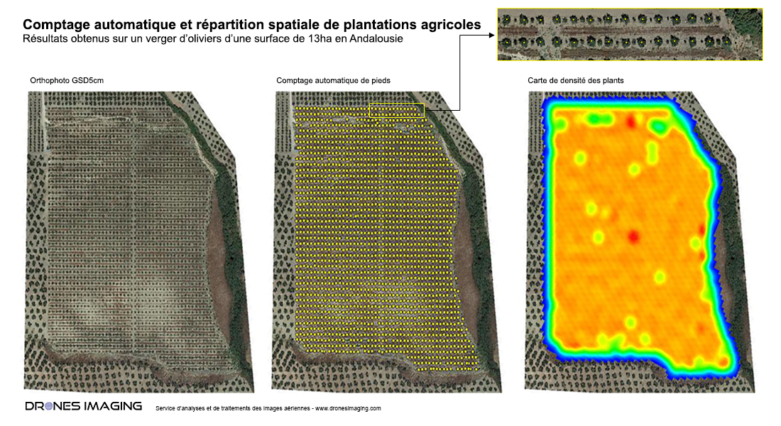
Comptage automatique par machine learning, résultats obtenus à partir d’un drone sur une parcelle d’oliviers de 13ha en Andalousie. Plan de synthèse réalisé aux formats Pdf et Dwg, dédié à l’analyse de la répartition spatiale des 1948 plantations détectées par apprentissage automatique.
L’apprentissage automatique est un champ d’étude de l’intelligence artificielle qui se fonde sur des approches mathématiques et statistiques pour donner aux ordinateurs la capacité d’« apprendre » à partir de données. Elle permet d’améliorer leurs performances à résoudre des tâches sans être explicitement programmés pour chacune. Plus largement, il concerne la conception, l’analyse, l’optimisation, le développement et l’implémentation de telles méthodes.
L’arrivée des algorithmes d’intelligence artificielle, couplée à la mise à disposition d’images satellites ou aériennes, sonne comme une révolution dans le domaine de la cartographie. En effet, il est désormais relativement rapide et peu coûteux de constituer des bases de données géographiques à partir de données raster.
INFORMATIONS TECHNIQUES
- Service de traitement d’images : société Drones Imaging.
- Capteur : A7R4 Quad Agrowing.
- Orthophoto : RVB GSD 5cm.
- Précision spatiale : centimétrique avec le récepteur GNSS EMLID Reach RS2.
- Surface totale inspectée : 13ha.
- Comptage automatique : 1948 oliviers comptabilisés.
- Logiciel de photogrammétrie : Agisoft Metashape.